| Agi River | |
|---|---|
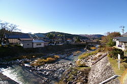
 The Agi River in Nakatsugawa The Agi River in Nakatsugawa | |
| Native name | 阿木川 (Japanese) |
| Location | |
| Country | Japan |
| Physical characteristics | |
| Source | |
| • location | Mount Yaki |
| • elevation | 1,709 m (5,607 ft) |
| Mouth | |
| • location | Kiso River |
| Length | 16.9 km (10.5 mi) |
| Basin features | |
| River system | Kiso River |
The Agi River (阿木川, Agi-gawa) is a river in Japan which flows through Gifu Prefecture. It is part of the Kiso River system.
Geography
The river originates from Mount Yaki on the border of Nakatsugawa and Ena and flows west. It flows through the Akigawa Dam and the Ōi Dam before emptying into the Kiso River.
History
Ōi-juku, a post town on the historical Nakasendō, was on the banks of the Agi River.
River communities
The Agi river flows through the cities of Ena and Nakatsugawa in Gifu Prefecture.
References
- Nakasendō Ōi-juku Archived 2011-06-13 at the Wayback Machine. Central Japan Railroad Company. Accessed November 1, 2010.
| |||||||||||||||
| |||||||||||||||
| |||||||||||||||
| |||||||||||||||
This Gifu Prefecture location article is a stub. You can help Misplaced Pages by expanding it. |
This article related to a river in Japan is a stub. You can help Misplaced Pages by expanding it. |