| Aich | |
|---|---|
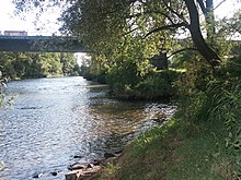
 The river flowing through Aichtal The river flowing through Aichtal | |
 | |
| Location | |
| Country | Germany |
| State | Baden-Württemberg |
| Physical characteristics | |
| Source | |
| • location | Holzgerlingen |
| Mouth | |
| • location | Neckar in Nürtingen |
| • coordinates | 48°39′N 9°20′E / 48.65°N 9.33°E / 48.65; 9.33 |
| • elevation | 268 metres (879 ft) above sea level |
| Length | 30.5 km (19.0 mi) |
| Basin size | 179 km (69 sq mi) |
| Basin features | |
| Progression | Neckar→ Rhine→ North Sea |
| Tributaries | |
| • right | Schaich |
The Aich is a river in Baden-Württemberg, Germany. It is approximately 30.5 kilometres (19.0 mi) long. It is a left tributary of the Neckar in Nürtingen.
Geography

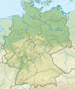
The Aich's origin is in Holzgerlingen. It flows to the north through Neuweiler and then south past Schönaich and Waldenbuch. It then flows through the Schönbuch nature park before passing through Betzenberg. After that, it flows through Aichtal before finally passing through Oberensingen and into the Neckar. The river is home to some species of white fish.
Tributaries
- Eschelbach (right), 2,2 km, 1,8 km
- Aischbach (right), 3,1 km, 2,8 km
- Keckbach (right), 1,6 km, 1,9 km
- Krähenbach (left), 4,8 km, 8,1 km
- Kohlklingenbach (right), 0,4 km
- Seebach (left), 2,1 km, 1,9 km
- Losklinge (left), 1,6 km
- Seebach (left), 6,9 km, 14,8 km
- Laubbach (right), 1,6 km
- Faulbach (right), 3,0 km
- Erbeerbühl(bach) (left), 1,4 km
- Groppbach (left), 1,7 km
- Seitenbach (right), 9,4 km
- Immenbach (right), 2,97 km
- Brunnenbach (right), 1,7 km
- Diebsklinge (right), 1,6 km
- Stellenbrunnen (right), 0,95 km
- Reichenbach (left), 13,3 km
- Schaich (right), 23,6 km
- Baumbach (left), 7,5 km
- Baiersbach (right), 2,07 km
- Finsterbach (left), 2,3 km
- Weiherbach (left), 4,4 km
- Follbach (left'), 3,5 km
- Teufelsklinge (left), 0,7 km
See also
References
- ^ Map services of the Baden-Württemberg State Office for the Environment, Survey and Conservation (Landesanstalt für Umwelt, Messungen und Naturschutz Baden-Württemberg)
This article related to a river in Baden-Württemberg is a stub. You can help Misplaced Pages by expanding it. |