| This article includes a list of references, related reading, or external links, but its sources remain unclear because it lacks inline citations. Please help improve this article by introducing more precise citations. (April 2017) (Learn how and when to remove this message) |
| Ain Qana عين قاناAinqana | |
|---|---|
| Municipality | |
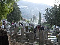
 Cemetery, Ain Qana 2007 Cemetery, Ain Qana 2007 | |
 | |
| Coordinates: 33°28′19″N 35°30′37″E / 33.47194°N 35.51028°E / 33.47194; 35.51028 | |
| Country | |
| Governorate | Nabatieh Governorate |
| District | Nabatieh District |
| Time zone | UTC+2 (EET) |
| • Summer (DST) | +3 |
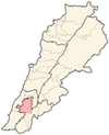
Ain Qana (Arabic: عين قانا), also known as Ainqana, is a municipality in the Nabatieh Governorate, Southern Lebanon.
The town is situated 680 meters above sea level, has an area of 630 hectares and a population of approximately 5585.
Demographics
In 2014 Muslims made up 99.36% of registered voters in Ain Qana. 97.36% of the voters were Shiite Muslims.
References
- Discover Lebanon
- "History of AinQana" by Safi Habhab
External links
- Official web page
- Ain Qana, Localiban

This Lebanon location article is a stub. You can help Misplaced Pages by expanding it.
