| This article needs additional citations for verification. Please help improve this article by adding citations to reliable sources. Unsourced material may be challenged and removed. Find sources: "Angle Tarn" Langstrath – news · newspapers · books · scholar · JSTOR (February 2024) (Learn how and when to remove this message) |
| Angle Tarn | |
|---|---|
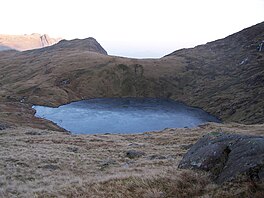
 facing SE, towards the top of Rossett Gill and Langdale facing SE, towards the top of Rossett Gill and Langdale | |
  | |
| Location | Lake District |
| Coordinates | 54°27′30″N 3°10′00″W / 54.45833°N 3.16667°W / 54.45833; -3.16667 |
| Type | Tarn |
| Basin countries | United Kingdom |
| Surface elevation | ~560 m (1,840 ft) |
Angle Tarn is a tarn to the north of Bowfell in the English Lake District. It drains into Langstrath Beck.
This should not be confused with Angle Tarn (Patterdale), a larger lake with the same name about 11.5 miles (18.5 km) to the south-west, also within the Lake District National Park.
References
- Baddeley, Mountford John Byrde (1880). The Thorough Guide to the English Lake District. Dulau & Company. p. 50. Retrieved 29 February 2024.
This Cumbria location article is a stub. You can help Misplaced Pages by expanding it. |