Commune in Grand Est, France
| Annelles | |
|---|---|
| Commune | |
 The Village The Village | |
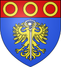
 Coat of arms Coat of arms | |
| Location of Annelles | |
  | |
| Coordinates: 49°25′43″N 4°25′12″E / 49.4286°N 4.42°E / 49.4286; 4.42 | |
| Country | France |
| Region | Grand Est |
| Department | Ardennes |
| Arrondissement | Rethel |
| Canton | Château-Porcien |
| Intercommunality | Pays Rethélois |
| Government | |
| • Mayor (2020–2026) | Anne Cuif |
| Area | 12.31 km (4.75 sq mi) |
| Population | 130 |
| • Density | 11/km (27/sq mi) |
| Time zone | UTC+01:00 (CET) |
| • Summer (DST) | UTC+02:00 (CEST) |
| INSEE/Postal code | 08014 /08310 |
| Elevation | 98–168 m (322–551 ft) (avg. 120 m or 390 ft) |
| French Land Register data, which excludes lakes, ponds, glaciers > 1 km (0.386 sq mi or 247 acres) and river estuaries. | |
Annelles (French pronunciation: [anɛl]) is a commune in the Ardennes department in the Grand Est region of northern France.
Geography
Annelles is located some 10 km south-east of Rethel and 4 km north-east of Juniville. It can be accessed by the D25 road from Juniville which passes through the heart of the commune and the village and continues to Saulces-Champenoises in the north-east. Apart from the village the commune is entirely farmland.
Neighbouring communes and villages
| Places adjacent to Annelles | ||||||||||||||||
|---|---|---|---|---|---|---|---|---|---|---|---|---|---|---|---|---|
| ||||||||||||||||
Heraldry
 |
The official status of the blazon is yet to be determined
Blazon:
|
Administration
| This list is incomplete; you can help by adding missing items. (April 2021) |
List of Successive Mayors
| From | To | Name | Party | Position |
|---|---|---|---|---|
| 1791 | 1807 | Sulpice Tocut | ||
| 1807 | 1816 | Jean-Rémy Coutin | ||
| 1816 | 1821 | François Baudet | ||
| 1821 | 1843 | Jean-Rémy Coutin | ||
| 1843 | 1843 | Jean-Baptiste Desterbay | ||
| 1843 | 1855 | Alexandre-Louis Lescuyer | General Councillor | |
| 1856 | 1871 | Maximillien Tocut | ||
| 1871 | 1874 | Jean-Baptiste Vilain | ||
| 1874 | 1891 | Jules-Armand Carré | ||
| 1891 | 1898 | Jean-Baptiste Fricotteau | ||
| 1898 | Joseph-Auguste Devaux | |||
| 1995 | 2001 | Dominique Tassot | ||
| 2001 | 2014 | Denis Fricotteau | ||
| 2014 | Current | Anne Cuif |
Population
The inhabitants of the commune are known as Annellois or Annelloises in French.
| Year | Pop. | ±% p.a. |
|---|---|---|
| 1968 | 95 | — |
| 1975 | 90 | −0.77% |
| 1982 | 89 | −0.16% |
| 1990 | 110 | +2.68% |
| 1999 | 118 | +0.78% |
| 2007 | 130 | +1.22% |
| 2012 | 138 | +1.20% |
| 2017 | 141 | +0.43% |
| Source: INSEE | ||
Culture and heritage
Religious heritage
The Church contains 3 Paintings: The Descent from the Cross, Christ and the Samaritan, and the Apparition of Madeleine (18th century)![]() which are registered as historical objects.
which are registered as historical objects.
The oldest families
From the 1600s onwards the most prominent families were: Rogelet, Mahaut, Desterbay, Thierard, Vuibert, Hinguerlot, Guillet, Micart, Carrelot, Bonnevie, Perinet, Detez, Coutin, Fricoteau, Tocut, Giot, Forest, Verdelet, Lacour, Misset, Bechard, Mayot, Fequant, Lambert, Guillemin, Prévoteau, Soibinet, Simon, Melin, and Gobron.
Notable people linked to the commune
- Jeanne Alexzandrine Pommery, born at Annelles on 13 April 1819 and died at Chigny-les-Roses (Marne) on 18 March 1890 was the founder of the House of Pommery, makers of Champagne wines.
See also
References
- "Répertoire national des élus: les maires". data.gouv.fr, Plateforme ouverte des données publiques françaises (in French). 2 December 2020.
- "Populations de référence 2022" (in French). The National Institute of Statistics and Economic Studies. 19 December 2024.
- ^ Google Maps
- List of Mayors of France
- Le nom des habitants du 08 - Ardennes, habitants.fr
- Population en historique depuis 1968, INSEE
- Ministry of Culture, Palissy PM08000634 3 Paintings: The Descent from the Cross, Christ and the Samaritan, and the Apparition of Madeleine (in French)
External links
- Annelles on the old National Geographic Institute website (in French)
- Annelles on Géoportail, National Geographic Institute (IGN) website (in French)
- Annelle on the 1750 Cassini Map