| This article needs additional citations for verification. Please help improve this article by adding citations to reliable sources. Unsourced material may be challenged and removed. Find sources: "Arcadia Valley" – news · newspapers · books · scholar · JSTOR (April 2020) (Learn how and when to remove this message) |


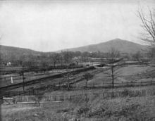
Arcadia Valley is a valley in the St. Francois Mountains of the Ozark Plateau in Iron County, Missouri, United States. Located about 80 miles south of St. Louis, the valley includes the towns of Arcadia, Ironton and Pilot Knob, all founded in the 19th century.
Arcadia Valley has been a non-indigenous settlement for over 300 years. It became a permanent settlement as a mining community, primarily mining iron and lead ore. It is known for its graceful antebellum homes and turn-of-the-20th-century mercantile buildings, as well as the red brick Iron County courthouse. It was a popular 19th-century summer resort. In 1864, during the Civil War, the valley was the site of a significant battle at Fort Davidson in Pilot Knob.
Elephant Rocks State Park is located in the valley, and Johnson's Shut-Ins State Park and Taum Sauk State Park are nearby.
See also
References
- Hart, Bill (2019). Historic Missouri Roadsides (2nd ed.). St. Louis, MO: Reedy Press. pp. 11–12. ISBN 1935806955. OCLC 903985963.
External links
- Arcadia Valley Chamber of Commerce webpage
- Iron County Homestead
- Missouri Mines State Historic Site
- Map of the Mineral resources of Missouri PDF
- Missouri lead mining brochure PDF
37°36′24″N 90°37′30″W / 37.6067°N 90.6249°W / 37.6067; -90.6249
This Iron County, Missouri state location article is a stub. You can help Misplaced Pages by expanding it. |