| Ban Na บ้านนา | |
|---|---|
| District | |
 Statue of King Chulalongkorn the Great at Armed Forces Academies Preparatory School Statue of King Chulalongkorn the Great at Armed Forces Academies Preparatory School | |
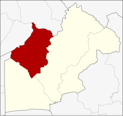
 District location in Nakhon Nayok province District location in Nakhon Nayok province | |
| Coordinates: 14°16′0″N 101°3′41″E / 14.26667°N 101.06139°E / 14.26667; 101.06139 | |
| Country | Thailand |
| Province | Nakhon Nayok |
| Seat | Ban Na |
| Area | |
| • Total | 388.4 km (150.0 sq mi) |
| Population | |
| • Total | 68,821 |
| • Density | 177/km (460/sq mi) |
| Time zone | UTC+7 (ICT) |
| Postal code | 26110 |
| Calling code | 037 |
| ISO 3166 code | TH-2603 |
Ban Na (Thai: บ้านนา, pronounced [bâːn nāː]) is a district (amphoe) in the western part of Nakhon Nayok province, central Thailand.
History
In the Ayutthaya era, the people of Tambon Pa Kha were elephant catchers (กองโพนช้าง), catching wild elephants to use as war elephants.
Ban Na district was established in 1903, then named Tha Chang District. As the original district office in Tambon Bang O was inconvenient for transportation and prone for flooding, the government moved the office to Suwannason Road in 1965.
When Nakhon Nayok Province was downgraded, the government transferred Ban Na District to Saraburi province. It became a district of Nakhon Nayok again on 9 May 1946 when the province was re-established.
Geography
Neighboring districts are (from the east clockwise) Mueang Nakhon Nayok and Ongkharak of Nakhon Nayok Province; Nong Suea of Pathum Thani province; and Wihan Daeng and Kaeng Khoi of Saraburi province.
The important water resource is Khlong Ban Na.
Administration
Provincial government
The district is divided into 10 subdistricts (tambons), which are further subdivided into 116 villages (mubans).

| No. | Subdistrict | Thai | Villages | Pop. |
|---|---|---|---|---|
| 1. | Ban Na | บ้านนา | 11 | 8,077 |
| 2. | Ban Phrao | บ้านพร้าว | 12 | 5,221 |
| 3. | Ban Phrik | บ้านพริก | 12 | 10,724 |
| 4. | Asa | อาษา | 8 | 2,509 |
| 5. | Thonglang | ทองหลาง | 8 | 5,053 |
| 6. | Bang O | บางอ้อ | 14 | 4,058 |
| 7. | Phikun Ok | พิกุลออก | 12 | 5,719 |
| 8. | Pa Kha | ป่าขะ | 13 | 8,749 |
| 9. | Khao Phoem | เขาเพิ่ม | 16 | 8,198 |
| 10. | Si Ka-ang | ศรีกะอาง | 10 | 10,513 |
| Total | 116 | 68,821 |
Local government
As of December 2023 there are two subdistrict municipalitues (thesaban tambon). Ban Na covers halve of Ban Na subdistrict and a small part of Phikun Ok subdistrict. Phikun Ok covers the remaining part of Phikun Ok subdistrict. There are nine subdistrict administrative organizations - SAO (ongkan borihan suan tambon - o bo toh).
| Ban Na subdistrict mun. | Pop. | website |
| Ban Na | 4,283 | banna-city |
| Phikun Ok | 348 | |
| Total | 4,631 |
| Subdistrict municipality | Pop. | website |
|---|---|---|
| Phikun Ok | 5,371 | pikulook |
| Subdistrict adm.org.-SAO |
Pop. | website |
|---|---|---|
| Ban Phrik | 10,724 | banprik |
| Si Ka-ang | 10,513 | srikaang |
| Pa Kha | 8,749 | pakha-banna |
| Khao Phoem | 8,198 | khaophoem |
| Ban Phrao | 5,221 | banpraow |
| Thonglang | 5,053 | thonglang |
| Bang O | 4,058 | bangor |
| Ban Na | 3,794 | bannanyk |
| Asa | 2,509 | arsa |
References
- ^ "Official statistics registration systems". Department of Provincial Administration. Retrieved 10 January 2025, year 2023 >village level >ExcelFile >no.2601-2699 >Excel line 13404-13904
{{cite web}}: CS1 maint: postscript (link) - "History - Ban Na District". Retrieved 18 January 2025.
- "Adminstrative area". Retrieved 10 January 2025.
External links
- amphoe.com (Thai)
| Districts of Nakhon Nayok | |
|---|---|