| Barka River | |
|---|---|
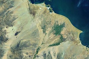
 The Tokar delta with the Barka (bottom) The Tokar delta with the Barka (bottom) | |
| Location | |
| Countries |
|
| Physical characteristics | |
| Source | |
| • location | Eritrean Highlands |
| Mouth | |
| • location | Red Sea at the Tokar Delta |
| • coordinates | 18°36′04″N 37°51′50″E / 18.601°N 37.864°E / 18.601; 37.864 |
| Length | 640 km (400 mi) |
| Basin size | 66,200 km (25,600 sq mi) |
| Discharge | |
| • average | 0.8 km/a (0.19 cu mi/a) (at mouth) |
| Basin features | |
| Tributaries | |
| • right | Anseba Shet' |
The Barka River (Arabic: nahr Baraka; Italian: fiume Barca) is a tributary river that flows from the Eritrean Highlands to the plains of Sudan. With a length of over 640 km, it rises just outside Asmara and flows in a northwestern direction through Agordat. The river merges with the Anseba River near the border with Sudan.
In Sudan, the Barka flows seasonally to a delta on the Red Sea, near the town of Tokar.
See also
References
- Fleuves Transfrontaliers Africains (PDF; 2,3 MB)
- "Important Bird Area factsheet: Western Plain: Barka river, Eritrea." BirdLife International. Retrieved 15 March 2010.
| Rivers of Eritrea | |
|---|---|
| Rivers | |
18°15′N 37°38′E / 18.250°N 37.633°E / 18.250; 37.633
This article related to a river in Eritrea is a stub. You can help Misplaced Pages by expanding it. |
This article related to a river in Sudan is a stub. You can help Misplaced Pages by expanding it. |