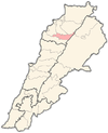
| Bazoun بزعون | |
|---|---|
| Village | |
 | |
| Coordinates: 34°14′29″N 35°59′15″E / 34.2414071°N 35.9874816°E / 34.2414071; 35.9874816 | |
| Country | |
| Governorate | North Governorate |
| District | Bsharri District |
| Area | |
| • Total | 2.27 km (0.88 sq mi) |
| Elevation | 1,390 m (4,560 ft) |
| Time zone | UTC+2 (EET) |
| • Summer (DST) | UTC+3 (EEST) |
| Dialing code | +06 |
Bazoun (also spelled Bazaoun or Bazaaoun) (Arabic: بزعون) is a Maronite village and municipality in the Bsharri District of Lebanon. Oral tradition has it that the first Lebanese settler in Guadeloupe was someone from the Debs family in Bazoun who went there in 1870. There are 4 schools in the town, 3 public and 1 private, with almost 850 students in total attending.
References
- "List of Lebanese municipalities (may 2016) | Drupal". www.libandata.org. Retrieved 2023-03-24.
- "THE LEBANESE IN GUADELOUPE" (PDF). ndu.edu.lb.
- Localiban. "Bazaaoun - Localiban". www.localiban.org. Retrieved 2023-03-24.
| Capital: Bsharri | ||
| Towns and villages |  | |
| Notable landmarks | ||
| Notable people | ||
This Lebanon location article is a stub. You can help Misplaced Pages by expanding it. |