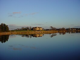
Reservoir in Falkirk
| Black Loch | |
|---|---|
 | |
 | |
| Location | Falkirk |
| Coordinates | 55°54′34″N 3°49′23″W / 55.90944°N 3.82306°W / 55.90944; -3.82306 |
| Type | Reservoir |
| Basin countries | Scotland |
The Black Loch is a small freshwater loch or reservoir in the Falkirk council area, Scotland. It is near the village of Limerigg and close to the boundary with North Lanarkshire.
The surface area of the Black Loch was enlarged in the early 1790s. A small canal was cut at the western side, so that run off from the moss would feed the loch and a dam built to enclose a larger volume of water which was required by the Monkland Canal at Woodhall. Therefore, this loch or reservoir to be more precise is not only the source of the North Calder Water but also an important source of the water supply for the Monkland Canal and further downstream, the Forth and Clyde Canal at Glasgow. The loch is now used for fly fishing, swimming, kayaking and paddle boarding.
References
- "Zoomable map from 1892-1949 with opacity slider". National Library of Scotland. Ordnance Survey. Retrieved 13 May 2017.
- "The Black Loch". OpenStreetMap. Retrieved 20 May 2017.
- "Stirlingshire 035.10". National Library of Scotland. Ordnance Survey 1898. Retrieved 20 May 2017.
- "Black Loch". Gazetteer for Scotland. Retrieved 2 March 2017.
This article related to a protected area in Scotland is a stub. You can help Misplaced Pages by expanding it. |