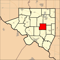
| Blair Precinct | |
|---|---|
 Location in Randolph County Location in Randolph County | |
| Coordinates: 38°02′39″N 089°44′33″W / 38.04417°N 89.74250°W / 38.04417; -89.74250 | |
| Country | United States |
| State | Illinois |
| County | Randolph |
| Area | |
| • Total | 17.52 sq mi (45.38 km) |
| • Land | 17.44 sq mi (45.18 km) |
| • Water | 0.08 sq mi (0.20 km) 0.004% |
| Elevation | 512 ft (156 m) |
| Population | |
| • Total | 290 |
| • Density | 16.6/sq mi (6.42/km) |
| GNIS feature ID | 1928447 |
Blair Precinct was a district of Randolph County, Illinois, USA. As of the 2000 census, its population was 290. As of the 2010 census, it had been split between Central Precinct and Palestine Precinct.
Geography
Blair Precinct covered an area of 45.38 square kilometres (17.52 sq mi).
References
- "US Board on Geographic Names". United States Geological Survey. 2007-10-25. Retrieved 2008-01-31.
- "U.S. Census website". United States Census Bureau. Retrieved 2008-01-31.
| Municipalities and communities of Randolph County, Illinois, United States | ||
|---|---|---|
| County seat: Chester | ||
| Cities | ||
| Villages | ||
| Precincts | ||
| Unincorporated communities | ||
This Randolph County, Illinois location article is a stub. You can help Misplaced Pages by expanding it. |
