| Bongoyo Island | |
|---|---|
| IUCN category II (national park) | |
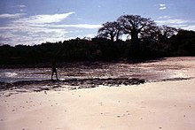
 Bongoyo Island beach Bongoyo Island beach | |
 | |
| Location | Dar es Salaam Region, Kinondoni District |
| Nearest city | Dar es Salaam |
| Coordinates | 6°41′S 39°16′E / 6.69°S 39.26°E / -6.69; 39.26 |
| Area | 19.1km² |
| Established | 1975 |
| Governing body | Marine Parks & Reserves Authority (Tanzania) |
| Website | DMRS |
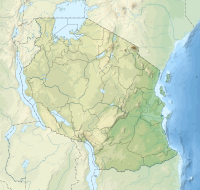
Bongoyo Island (Kisiwa cha Bongoyo, in Swahili) is a protected, uninhabited island under the Dar es Salaam Marine Reserve with the IUCN category II located within Kinondoni District of Dar es Salaam Region in Tanzania. The island situated 2.5 km north of the country's largest city, Dar es Salaam in the indian Ocean. It is the most frequently visited of the four islands of the Dar es Salaam Marine Reserve System (DMRS) and a popular daytrip for both tourists and Tanzanian residents alike for snorkelling and sunbathing. North of the island is Mbudya Island and to the west is Pangavini Island. The island is home to some of Tanzania's largest specimens of endangered coconut crabs.
Geography
The island has a very rocky shore and only two beaches. All visitors visit the beach at the northwestern tip of the island, where the boats moor and where there are some huts, drinks and food. The much longer but narrower beach along the northeastern side has no facilities and is mostly deserted. The entire island (apart from the beaches) is covered in dense forest and has a few walking trails, so only a few people venture there. The terrain is somewhat treacherous with sharp rocks. In the middle of the island one finds the remains of a German colonial building at 6°42′8.48″S 39°16′11.49″E / 6.7023556°S 39.2698583°E / -6.7023556; 39.2698583, clearly visible on Google Maps. The Indian Ocean has penetrated the northern shore of the island, creating a tidal lagoon along whose shores there are some mangroves.
Access
The island lies close to the Msasani Peninsula (in the Kinondoni district of the city) and is reachable by means of a 30-minute boat ride from the mainland. The point of departure for most visitors to the island is 'The Slipways' hotel complex on the western side of the Msasani Peninsula.

See also
References
- Levine, Arielle. (2010). Local Responses to Marine Conservation in Zanzibar, Tanzania. Journal of International Wildlife Law and Policy. July–December 2004. 183-202. 10.1080/13880290490883241
- "Dar Es Salaam Marine Reserves System". Retrieved 19 May 2023.
- Caro, Tim, et al. "A case study of the coconut crab Birgus latro on Zanzibar highlights global threats and conservation solutions." Oryx 55.4 (2021): 556-563.
- "Things you need to know about Bongoyo Island". Retrieved 19 May 2023.
| Kinondoni District | |
|---|---|
| Headquarters: Ndugumbi | |
| Wards | |
| Native Peoples | |
| National Historic Sites | |
| Rivers and Lakes |
|
| National Parks and Forest Reserves |
|
| Islands | |
| Dar es Salaam | |
|---|---|
| Categories | |
| Districts | |
| History | |
| Education | |
| Transport | |
| Landmarks | |
| National Parks | |
| |
External links
| Protected areas of Tanzania | |
|---|---|
| National Parks | |
| Game reserves | |
| Forest reserves and nature forest reserves | |
| Marine parks and reserves |
|
| Organizations |
|
This Dar es Salaam Region location article is a stub. You can help Misplaced Pages by expanding it. |