Misplaced Pages

Brakpan

Article snapshot taken from[REDACTED] with creative commons attribution-sharealike license. Give it a read and then ask your questions in the chat. We can research this topic together.
(Redirected from Brakpan, Gauteng) Town in Gauteng, South Africa
Brakpan
Town
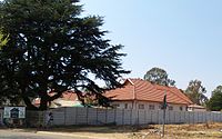
Pentecost Protestant Church, Abramowitz Street, Brakpan
Brakpan is located in GautengBrakpanBrakpanShow map of GautengBrakpan is located in South AfricaBrakpanBrakpanShow map of South AfricaBrakpan is located in AfricaBrakpanBrakpanShow map of Africa
Coordinates: 26°14′07″S 28°22′12″E / 26.23528°S 28.37000°E / -26.23528; 28.37000
CountrySouth Africa
ProvinceGauteng
MunicipalityEkurhuleni
Area
 • Total182.81 km (70.58 sq mi)
Elevation1,631 m (5,351 ft)
Population
 • Total73,080
 • Density400/km (1,000/sq mi)
Racial makeup (2011)
 • Black African39.7%
 • Coloured2.5%
 • Indian/Asian4.1%
 • White53.3%
 • Other0.4%
First languages (2011)
 • Afrikaans47.2%
 • English16.5%
 • Zulu14.3%
 • Sotho4.8%
 • Other17.2%
Time zoneUTC+2 (SAST)
Postal code (street)1540
PO box1540
Area code011
Websitehttp://www.brakpan-online.co.za/

Brakpan is a mining town on the East Rand of Gauteng, South Africa, approximately 38 kilometres (23.6 mi) east of Johannesburg.

History

The name Brakpan comes from a small pan on a farm called Weltevreden, which was filled with very brackish water and was probably referred to as the "brakpan," and it was near this pan that the first settlement started. In 1888, a coal seam was discovered and a coal mine under the name of Brakpan Collieries was started. When a railway line was constructed from Germiston to Springs, Brakpan became one of the stations along the route.

With gold fever running high on the Witwatersrand in the early years of the twentieth century, it was not long before gold was discovered. In 1905, Brakpan Mines Company sunk its first two gold mining shafts. One of its claims to fame was that it had the highest mine dump in the world at that time, 120 metres (390 ft) above ground level. This was higher than any of the pyramids of Egypt except the Pyramid of Cheops.

From 1905 the village began to grow rapidly, remaining a suburb of Benoni until 1912 when it was granted the status of a municipality and proclaimed as a town. Brakpan's central position makes it a good distribution centre for industry, especially engineering works and foundries. In the late 1990s the municipality approved the construction of a huge casino and entertainment complex, Carnival City, which opened the town to tourists and provided much-needed jobs for the people.

The first activity which drew people to the area was the British coal mining in 1888 and the large coal powered power station also built by the British. A tram line to Johannesburg was built at this time to service the power station.

The Main Reef Road (today part of the R29) linked Brakpan to all the other mining towns in the Witwatersrand. Brakpan was a suburb of Benoni from 1914–1919, when it was granted municipal status. The Brakpan miners were involved in the miners' strike of 1922. The town has gradually lost its importance as a gold mining area as the surrounding mines suffered from low yield over high cost. Many British residents emigrated during the apartheid era leaving a vacuum in the town which was filled by mostly Afrikaner farmers who had lost interest in farming.

Situated between Springs and Benoni, it forms part of the Ekurhuleni Metro.

Brakpan is often used in memes in South African online communities, often depicted in a way similar to Southern US locations in US centric memes.

Transport

Roads

Brakpan is mainly located along the N17 highway leading eastwards from Boksburg and Johannesburg to Springs and Secunda (102 km). In passing through Brakpan, the N17 gives access to the town via the exits at Heidelberg Road, Denne Road and Ergo Road.

Running parallel to the N17, the R554 (Elsburg Road; Springs Road) leads south-westwards to Alberton – 34 km and eastwards to Springs. The R23 (Heidelberg Road) skirts Brakpan to the west, leading northwards to Benoni and southwards to Heidelberg – 35 km.

The M45 (Prince George Avenue) leads north-westwards to Benoni and southwards to KwaThema. The M46 leads westwards from Brakpan to Boksburg and eastwards to Springs. In passing through Brakpan, the M46 holds several names such as Airport Road, Athlone Avenue, Voortrekker Road, Prince George Avenue and Olympia Road. Voortrekker Road is the main street through the Brakpan CBD.

References

  1. ^ "Main Place Brakpan". Census 2011.
  2. ^ Conolly, Denis (1975). The Tourist in South Africa. Travel-Guide (PTY) LTD. ASIN B0000E7XZN.
  3. "Alberton property | find property for sale and estate agents in Alberton | properties Alberton South Africa". Sahometraders.com. Archived from the original on 2012-03-03. Retrieved 2011-01-15.
  4. Carnival City's web page
  5. "29 Brakpan ideas | brakpan, funny pictures, funny". Pinterest. Retrieved 2022-02-11.
Greater Johannesburg
Natural environment
Geology
Topography
Rivers and
wetlands
Vaal-Orange basin
Limpopo basin
Climate
Cradle of
Humankind
Fossil sites
Biodiversity
Vegetation types
Parks and gardens
Nature reserves
Human impact
Communities
Inner City
Northern
suburbs and
environs
Southern
suburbs and
environs
East Rand
West Rand
Cityscape
Landmarks
Public art
Statues
Civic
buildings
Office
buildings
Skyscrapers
Residential
buildings
Skyscrapers
Structures
Urban planning
Heritage conservation
Government
National government
Courts
Chapter nine institutions
Provincial government
Municipalities
African Union
Politics
Governing parties
Political organisations
and parties based in
Greater Johannesburg
Political parties
Trade unions
Other political
organisations
History
Fortifications
Monuments
and memorials
Cemeteries
Historical
sites
Houses
Historical
companies and
organisations
Companies
Political
organisations
Other organisations
Events
Culture
Cultural heritage
Performance art
Musical ensembles
Theatres
Events and festivals
Museums and art
galleries
Defunct
Clubs and societies
Religion
Places of
worship
Churches
Anglican
Baptist
Calvinist
Catholic
Maronite
Greek
Orthodox
Latter-day
Saints
Lutheran
Synagogues
Orthodox
Historical
Progressive
Mosques
Hindu temples
Scientology centres
Media
Mass media
Magazines
Defunct
Newspapers
Defunct
Radio stations
Television channels
Defunct
Film studios
Defunct
Record labels
Game studios
Cultural references
Economy
Companies
Companies based in Greater Johannesburg
Diversified
conglomerates
Airlines
Defunct
Construction
and engineering
Energy
Financial
Banks
Hospitality
ICT
Legal
Manufacturing
Media
Mining
Retail and
marketing
Restaurant
franchises
Services
Transport
State-owned
enterprises
Professional
associations
Mining
Mines
Shopping centres
Hotels and resorts
Venues
Restaurants,
bars and cafés
Tourism
Cultural villages
Transport
Civil aviation
Airports
Defunct
Road transport
Rail transport
Train stations
Sports
Sports governing
bodies based in
Greater Johannesburg
Teams
Soccer
Former
Rugby
Cricket
Basketball
Equestrian sports
Sports events
Sports venues
Stadia and
arenas
Defunct
Golf courses
Equestrian
venues
Motorsports
venues
Education and research
Libraries
Universities
University of Johannesburg
Campuses
Faculties
University of the Witwatersrand
Faculties
Other tertiary
institutions
  • AFDA
  • Central Johannesburg College
  • CityVarsity
  • Damelin
  • Damelin Correspondence College
  • Inscape Design College
  • Lyceum College
  • Midrand Graduate Institute
  • Business schools
    Religious institutions
    State schools
    Private schools
    Alternative schools
    International schools
    Services
    Hospitals
    Historical
    Water supply
    and sanitation
    Dams
    Water towers
    Electricity supply
    Defunct power stations
    Law enforcement and
    emergency services
    Charities and NGOs
    Military units and formations
    Army units
    Regular
    Reserve
    SAMHS units
    Disbanded units
    Army
    Commandos
    Special Forces
    SAAF
    Communities of Ekurhuleni, Gauteng
    Seat: Germiston
    Places in Ekurhuleni
    Ekurhuleni within South Africa
    Ekurhuleni within South Africa
    Suburbs of Kempton Park
    Suburbs of Germiston
    • Activia Park
    • Albemarle
    • Annex Park
    • Barvallen
    • Castleview
    • Creston Hill
    • Cruywagen Park
    • Dania Park
    • Dawnview
    • Dewittsrus
    • Delmenville
    • Delmore
    • Delville
    • Denlee
    • Dinwiddie
    • Driehoek
    • Dukathole
    • Eduwin
    • Elandsfontein
    • Elandshaven
    • Elsburg
    • Elspark
    • Estera
    • Fishers Hill
    • Geldenhuys
    • Geldenhuys Sihs
    • Georgetown
    • Gerdview
    • Germiston East
    • Germiston North
    • Germiston South
    • Germiston West
    • Golden Grove
    • Golden Walk
    • Gosforth Park
    • Harmelia
    • Hazeldean
    • Hazelpark
    • Henville
    • Highway Gardens
    • Homestead
    • Industries East
    • Industries West
    • Jerusalem
    • Junction Hill
    • Jupiter
    • Klippoortjie
    • Knights
    • La Lucia Gardens
    • Lambton
    • Lambton Gardens
    • Leondale
    • Magagula
    • Makausi
    • Malvern East
    • Marlands
    • Meadowbrook
    • Meadowdale
    • Mimosa Park
    • Norton
    • Palmridge
    • Parkhill Gardens
    • Pharoe Park
    • Phumula
    • Phumula Gardens
    • Pirowville
    • Primrose
    • Primrose East
    • Primrose Hill
    • Rand Airport
    • Rondebult
    • Roodebult
    • Roodekop
    • Rustivia
    • Simmerfield
    • Solheim
    • Staatsdorp
    • Sunnyridge
    • Sunnyrock
    • Symhurst
    • Symridge
    • Tedstoneville
    • Tunney
    • Union
    • Wadeville
    • Wannenberg
    • Wannenberghoogte
    • Webber
    • Woodmere
    • Wychwood
    Categories:
    Brakpan Add topic