| Coari River | |
|---|---|
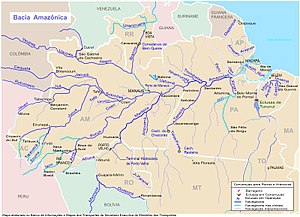
 Coari River center-left (west of Manaus) Coari River center-left (west of Manaus) | |
| Location | |
| Country | Brazil |
| State | Amazonas |
| Physical characteristics | |
| Source | |
| • location | Amazonas |
| • coordinates | 5°24′24.3216″S 65°45′23.7852″W / 5.406756000°S 65.756607000°W / -5.406756000; -65.756607000 |
| • elevation | 96 m (315 ft) |
| Mouth | Solimões |
| • location | Coari, Amazonas |
| • coordinates | 4°4′34.7808″S 63°8′9.6864″W / 4.076328000°S 63.136024000°W / -4.076328000; -63.136024000 |
| • elevation | 21 m (69 ft) |
| Length | 530 km (330 mi) |
| Basin size | 37,500 km (14,500 sq mi) |
| Discharge | |
| • location | Coari (near mouth) |
| • average | 1,850 m/s (65,000 cu ft/s) |
| Basin features | |
| River system | Solimões |
| Tributaries | |
| • left | Itanhauã, Muã, Urucu, Aruã |
Coari River is a tributary of the Amazon River (Solimões section) in the Amazonas state in north-western Brazil.
See also
References
- Ziesler, R.; Ardizzone, G.D. (1979). "Amazon River System". The Inland waters of Latin America. Food and Agriculture Organization of the United Nations. ISBN 92-5-000780-9. Archived from the original on 8 November 2014.
- ^ "HYDROLOGIE DU BASSIN AMAZONIEN" (PDF). 1997. ISBN 2-7011-1532-9.
This article related to a river in the Brazilian state of Amazonas is a stub. You can help Misplaced Pages by expanding it. |