Human settlement in England
| Corhampton | |
|---|---|
 River Meon, Corhampton Mill River Meon, Corhampton Mill | |
 | |
| OS grid reference | SU6020 |
| Civil parish | |
| District | |
| Shire county | |
| Region | |
| Country | England |
| Sovereign state | United Kingdom |
| Post town | Winchester |
| Postcode district | SO32 |
| Dialling code | 01489 |
| Police | Hampshire and Isle of Wight |
| Fire | Hampshire and Isle of Wight |
| Ambulance | South Central |
| UK Parliament | |
| Website | Corhampton and Meonstoke Parish Council |
| 50°58′41″N 1°07′59″W / 50.978°N 1.133°W / 50.978; -1.133 | |
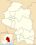
Corhampton is a village and former civil parish, now in the parish of Corhampton and Meonstoke, in the Winchester district, in the county of Hampshire, England. It lies on the western bank of the River Meon. In 1931 the parish had a population of 87. On 1 April 1932 the parish was abolished and merged with Meonstoke to form "Corhampton and Meonstoke".
Archaeology
Bronze Age bowl barrows and "Celtic fields" and circular earthworks probably dating from the Iron Age have been found on Corhampton Down in the west of the parish.
Parish church

The Church of England parish church is Saxon and was built around 1020. The font is Norman and there are 13th-century wall paintings in the chancel and a tide dial on the south wall.
See: https://en.wikipedia.org/Corhampton_Church
In the churchyard is an ancient yew with a 26 ft girth.
References
- "Population statistics Corhampton AP/CP through time". A Vision of Britain through Time. Retrieved 15 May 2023.
- "Relationships and changes Corhampton AP/CP through time". A Vision of Britain through Time. Retrieved 15 May 2023.
- "Corhampton and Meonstoke". Hampshire Treasures Volume 1 Winchester City District P66. Hampshire County Council. 2006. Archived from the original on 1 November 2005. Retrieved 29 March 2008.
- ^ Pevsner & Lloyd 1967, p. 182
- "Corhampton and Meonstoke". Hampshire Treasures Volume 1 Winchester City District P85. Hampshire County Council. 2006. Archived from the original on 25 September 2005. Retrieved 29 March 2008.
Sources
- Pevsner, Nikolaus; Lloyd, David (1967). Hampshire and the Isle of Wight. The Buildings of England. Harmondsworth: Penguin Books. p. 182.
External links
| Electoral wards and parishes in the City of Winchester District, Hampshire, England (since 2016 boundary changes) | ||
|---|---|---|
 Wards Wards Parishes Parishes | Wonston and Micheldever | |
| The Worthys | ||
| Alresford and Itchen | ||
| Winchester |
| |
| Badger Farm and Oliver's Battery | ||
| Colden Common and Twyford | ||
| Upper Meon Valley | ||
| Bishops Waltham | ||
| Central Meon Valley | ||
| Whiteley and Shedfield | ||
| Denmead | ||
| Southwick and Wickham | ||
| (Wards ordered from north-west corner, across the map, and then progressively south and east) | ||
This Hampshire location article is a stub. You can help Misplaced Pages by expanding it. |
