| This article needs additional citations for verification. Please help improve this article by adding citations to reliable sources. Unsourced material may be challenged and removed. Find sources: "Crooked Tree, Belize" – news · newspapers · books · scholar · JSTOR (June 2023) (Learn how and when to remove this message) |
| Crooked Tree | |
|---|---|
 | |
| Coordinates: 17°46′34″N 88°32′31″W / 17.77611°N 88.54194°W / 17.77611; -88.54194 | |
| Country | |
| District | Belize District |
| Constituency | Belize Rural North |
| Climate | Am |
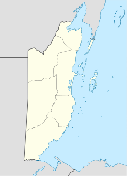
Crooked Tree is a settlement located in the nation of Belize. It is a mainland village located in the Belize District.
Demographics
At the time of the 2010 Census, Crooked Tree had a population of 805. Of these, 85.2% were Creole, 10.3% Mixed, 2.4% Mestizo, 0.9% Caucasian, 0.7% African, 0.2% Garifuna and 0.2% East Indian.
External links
 Crooked Tree travel guide from Wikivoyage
References
17°46′N 88°32′W / 17.767°N 88.533°W / 17.767; -88.533
This article about the geography of Belize is a stub. You can help Misplaced Pages by expanding it. |