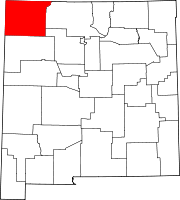
Census-designated place in New Mexico, United States
| Crouch Mesa, New Mexico | |
|---|---|
| Census-designated place | |
  | |
| Coordinates: 36°45′17″N 108°4′16″W / 36.75472°N 108.07111°W / 36.75472; -108.07111 | |
| Country | United States |
| State | New Mexico |
| County | San Juan |
| Area | |
| • Total | 20.67 sq mi (53.55 km) |
| • Land | 20.67 sq mi (53.55 km) |
| • Water | 0.00 sq mi (0.00 km) |
| Elevation | 5,771 ft (1,759 m) |
| Population | |
| • Total | 5,257 |
| • Density | 254.28/sq mi (98.18/km) |
| Time zone | UTC-7 (Mountain (MST)) |
| • Summer (DST) | UTC-6 (MDT) |
| ZIP Code | 87401 (Farmington) 87410 (Aztec) |
| Area code | 505 |
| FIPS code | 35-18905 |
| GNIS feature ID | 2806751 |
Crouch Mesa is an unincorporated community and census-designated place (CDP) in San Juan County, New Mexico, United States. It was first listed as a CDP prior to the 2020 census.
The CDP is in northeastern San Juan County, bordered to the southwest by the city of Farmington and to the south by Lee Acres. Crouch Mesa Road (County Road 350) is the main route through the community, leading south 4 miles (6 km) to U.S. Route 64 in Lee Acres and north 3.5 miles (5.6 km) to State Road 516 in Flora Vista.
Demographics
| Census | Pop. | Note | %± |
|---|---|---|---|
| 2020 | 5,257 | — | |
| U.S. Decennial Census | |||
Education
Crouch Mesa is divided between Farmington Municipal Schools (the majority) and Aztec Municipal Schools (a minority section). Aztec High School is the local high school of the latter.
References
- "ArcGIS REST Services Directory". United States Census Bureau. Retrieved October 12, 2022.
- ^ U.S. Geological Survey Geographic Names Information System: Crouch Mesa Census Designated Place
- ^ "Census Population API". United States Census Bureau. Retrieved October 12, 2022.
- "Census of Population and Housing". Census.gov. Retrieved June 4, 2016.
- "2020 CENSUS - SCHOOL DISTRICT REFERENCE MAP: San Juan County, NM" (PDF). U.S. Census Bureau. Retrieved July 12, 2022.
| Municipalities and communities of San Juan County, New Mexico, United States | ||
|---|---|---|
| County seat: Aztec | ||
| Cities |  | |
| CDPs |
| |
| Other communities | ||
| Indian reservations | ||
| Footnotes | ‡This populated place also has portions in an adjacent county or counties | |
This New Mexico state location article is a stub. You can help Misplaced Pages by expanding it. |