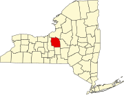
Census-designated place in New York, United States
| De Witt, New York | |
|---|---|
| Census-designated place | |
  | |
| Coordinates: 43°2′6″N 76°4′4″W / 43.03500°N 76.06778°W / 43.03500; -76.06778 | |
| Country | United States |
| State | New York |
| County | Onondaga |
| Town | DeWitt |
| Area | |
| • Total | 6.50 sq mi (16.85 km) |
| • Land | 6.49 sq mi (16.80 km) |
| • Water | 0.02 sq mi (0.05 km) |
| Elevation | 473 ft (144 m) |
| Population | |
| • Total | 11,247 |
| • Density | 1,734.04/sq mi (669.54/km) |
| Time zone | UTC-5 (Eastern (EST)) |
| • Summer (DST) | UTC-4 (EDT) |
| ZIP Codes | 13214 (De Witt) 13057 (East Syracuse) 13078 (Jamesville) 13224 (Syracuse) |
| Area code(s) | 315/680 |
| FIPS code | 36-20467 |
| GNIS feature ID | 2806956 |
De Witt is a census-designated place (CDP) in the town of DeWitt, Onondaga County, New York, United States. It was first listed as a CDP prior to the 2020 census.
The CDP is in eastern Onondaga County, in the southern part of the town of DeWitt. It is bordered to the northwest by the city of Syracuse, to the north by the village of East Syracuse, and to the east and south by Interstate 481, which separates it from the rest of the town of DeWitt. East Genesee Street is the main road through the CDP, leading west 4 miles (6 km) to downtown Syracuse and east 3 miles (5 km) to Fayetteville. New York State Route 92 follows East Genesee Street within the De Witt CDP, while State Route 5 follows it in the eastern part of the CDP, before turning north to take Erie Boulevard toward downtown.
Demographics
| Census | Pop. | Note | %± |
|---|---|---|---|
| 2020 | 11,247 | — | |
| U.S. Decennial Census | |||
Education
All of the CDP is in the Jamesville-DeWitt Central School District.
Le Moyne College is in the northwest corner of the CDP.
References
- "ArcGIS REST Services Directory". United States Census Bureau. Retrieved September 20, 2022.
- ^ "De Witt Census Designated Place". Geographic Names Information System. United States Geological Survey, United States Department of the Interior.
- "Census of Population and Housing". Census.gov. Retrieved June 4, 2016.
- "2020 CENSUS - SCHOOL DISTRICT REFERENCE MAP: Onondaga County, NY" (PDF). U.S. Census Bureau. Retrieved December 8, 2024. - Text list
- "2020 CENSUS - CENSUS BLOCK MAP: De Witt CDP, NY" (PDF). U.S. Census Bureau. Retrieved December 8, 2024.
Le Moyne Colg
| Municipalities and communities of Onondaga County, New York, United States | ||
|---|---|---|
| County seat: Syracuse | ||
| City |  | |
| Towns | ||
| Villages | ||
| CDPs | ||
| Other hamlets | ||
| Indian reservation | ||
| Footnotes | ‡This populated place also has portions in an adjacent county or counties | |
This article about a location in Onondaga County, New York is a stub. You can help Misplaced Pages by expanding it. |