Municipality in Quebec, Canada
| Dixville | |
|---|---|
| Municipality | |
 | |
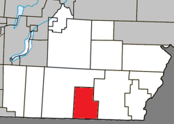
 Location within Coaticook RCM Location within Coaticook RCM | |
 | |
| Coordinates: 45°04′N 71°46′W / 45.07°N 71.77°W / 45.07; -71.77 | |
| Country | |
| Province | |
| Region | Estrie |
| RCM | Coaticook |
| Constituted | September 27, 1995 |
| Government | |
| • Mayor | Réal Ouimette |
| • Federal riding | Compton—Stanstead |
| • Prov. riding | Saint-François |
| Area | |
| • Total | 77.40 km (29.88 sq mi) |
| • Land | 76.56 km (29.56 sq mi) |
| Population | |
| • Total | 732 |
| • Density | 9.6/km (25/sq mi) |
| • Pop 2016-2021 | |
| • Dwellings | 303 |
| Time zone | UTC−5 (EST) |
| • Summer (DST) | UTC−4 (EDT) |
| Postal code(s) | J0B 1P0 |
| Area code | 819 |
| Highways | |
| Website | www |
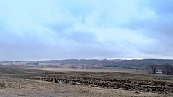
Dixville is a municipality in Quebec, Canada, situated east of Stanstead, in the regional county municipality of Coaticook and the region of Eastern Township.
History
Dixville was originally known as "Drew's Mills", named after a settler, who the early 1800s, had built a saw mill at this location on the Coaticook River. The settlement began around the year 1830; the site was back then part of the Township of Barford. A Mr. Drew set up a dwelling on the banks of the Coaticook River, cleared land to build a sawmill beside a dam which he had built. In 1836, John Wright came to join up with Drew. Soon after, others came to this place and the village became known as Drew's Mills.
Shortly before the turn of the century, it was renamed Dixville, after Richard Dick Baldwin, who was known as "Uncle Dick" by the majority of the town's residents.
The name Saint-Mathieu-de-Dixville was used in the past. It may be the name of the local Roman Catholic church.
Demographics
Population
Population trend:
| Census | Population | Change (%) |
|---|---|---|
| 2021 | 732 | |
| 2016 | 696 | |
| 2011 | 710 | |
| 2006 | 685 | |
| 2001 | 746 | |
| 1996 | 751 | |
| 1991 | 796 | N/A |
Dam
There is a dam in the municipality at 45° 04' 07" 71° 46' 15"
See also
References
- "Banque de noms de lieux du Québec: Reference number 306779". toponymie.gouv.qc.ca (in French). Commission de toponymie du Québec.
- ^ "Répertoire des municipalités: Geographic code 44023". www.mamh.gouv.qc.ca (in French). Ministère des Affaires municipales et de l'Habitation.
- ^ "Profile table, Census Profile, 2021 Census of Population - Dixville, Municipalité (MÉ) [Census subdivision], Quebec". 9 February 2022.
- Dixville Home inc. celebrates its 50th anniversary, societehistoirecoaticook.ca
- History of Dixville, societehistoirecoaticook.ca
- Statistics Canada: 1996, 2001, 2006, 2011, 2016, 2021 census
External links
- [REDACTED] Media related to Dixville, Quebec at Wikimedia Commons
- (in French) Official site
| Places adjacent to Dixville, Quebec | ||||||||||||||||
|---|---|---|---|---|---|---|---|---|---|---|---|---|---|---|---|---|
| ||||||||||||||||
| Cities | |
|---|---|
| Municipalities | |
| Townships | |
| Communities | |
| |
This Estrie location article is a stub. You can help Misplaced Pages by expanding it. |