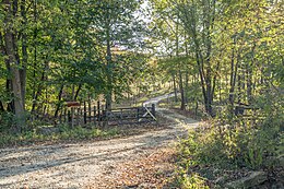
Unincorporated community in Indiana, United States
| Doans | |
|---|---|
| Unincorporated community | |
 | |
  | |
| Coordinates: 38°55′09″N 86°50′58″W / 38.91917°N 86.84944°W / 38.91917; -86.84944 | |
| Country | United States |
| State | Indiana |
| County | Greene |
| Township | Taylor |
| Elevation | 610 ft (190 m) |
| Time zone | UTC-5 (Eastern (EST)) |
| • Summer (DST) | UTC-4 (EDT) |
| ZIP code | 47457 |
| Area code | 812 |
| GNIS feature ID | 433586 |
Doans is an unincorporated community in Taylor Township, Greene County, in the U.S. state of Indiana.
History
Doans took its name from Doans Creek. A post office was established at Doans in 1899, and remained in operation until it was discontinued in 1971.
References
- ^ U.S. Geological Survey Geographic Names Information System: Doans, Indiana
- Baker, Ronald L. (October 1995). From Needmore to Prosperity: Hoosier Place Names in Folklore and History. Indiana University Press. p. 114. ISBN 978-0-253-32866-3.
It was renamed Doans, for nearby Doans Creek...
- "Greene County". Jim Forte Postal History. Archived from the original on September 13, 2014. Retrieved September 3, 2014.
| Municipalities and communities of Greene County, Indiana, United States | ||
|---|---|---|
| County seat: Bloomfield | ||
| Cities | ||
| Towns | ||
| Townships | ||
| CDPs | ||
| Other communities | ||
| Footnotes | ‡This populated place also has portions in an adjacent county or counties | |
This Greene County, Indiana location article is a stub. You can help Misplaced Pages by expanding it. |
