| Eticuera Creek | |
|---|---|
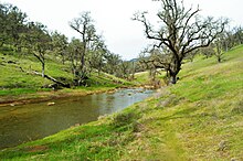
 The turbulent waters of Eticuera Creek after a large storm, February 2017 The turbulent waters of Eticuera Creek after a large storm, February 2017 | |
 | |
| Location | |
| Country | United States |
| State | California |
| Region | Northern Napa County |
| Physical characteristics | |
| Mouth | Lake Berryessa |
| • coordinates | 38°40′26″N 122°16′09″W / 38.6739°N 122.2691°W / 38.6739; -122.2691 |
| Length | 14 mi (23 km) |
| Basin features | |
| Tributaries | |
| • right | Knoxville Creek, Zim Zim Creek, Adams Creek |

Eticuera Creek is one of four primary tributaries that drain into Lake Berryessa in northern Napa County, California. The other three are Pope Creek, Capell Creek, and Putah Creek.
Eticuera Creek drains a watershed that is approximately 53 square miles (140 km). The creek generally drains in a north to south direction.
The upper reaches of the watershed also once supported the now defunct mining town of Knoxville.
References
- "Eticuera Creek (in Napa County, CA)". california.hometownlocator.com. Retrieved 2017-05-08.
- "Learn about a public-private partnership to restore Upper Putah Creek". Davis Enterprise. 2011-08-31. Retrieved 2017-05-08.
This article related to a river in California is a stub. You can help Misplaced Pages by expanding it. |