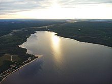
| Faillon Lake | |
|---|---|
 Watershed of Nottaway River Watershed of Nottaway River | |
 | |
| Location | Senneterre |
| Coordinates | 48°20′11″N 76°39′28″W / 48.33639°N 76.65778°W / 48.33639; -76.65778 |
| Type | Natural |
| Primary inflows |
|
| Primary outflows | Mégiscane River |
| Basin countries | Canada |
| Max. length | 18.3 kilometres (11.4 mi) |
| Max. width | 2.2 kilometres (1.4 mi) |
| Surface area | 24.8 kilometres (15.4 mi) |
| Surface elevation | 355 metres (1,165 ft) |

Faillon Lake is a freshwater body of the townships of Faillon (northeastern part) and Boisseau (southwestern part), in the territory of Senneterre, in La Vallée-de-l'Or Regional County Municipality (RCM), in the administrative region of Abitibi-Témiscamingue, in the province of Quebec, in Canada.
Lake Faillon is crossed to the Southwest by the current of the Mégiscane River.
Forestry is the main economic activity of the sector; recreational tourism activities come second. Its surface is generally frozen from the beginning of December to the end of April.
The hydrographic slope of Lake Faillon is mainly served by a forest road that goes north-east on the north bank of the Mégiscane River. The southwestern part of the lake is served by another branch of the forest road that runs east.
Geography
This lake of 18.3 kilometres (11.4 mi) comprises is formed by an enlargement of the Mégiscane River. This lake includes Kwacidawagak Bay, located on the south shore of the lake; this bay receives the waters of a creek coming from the East.Lake Faillon supplies mainly to the North-East by the Mégiscane River and to the North-West by the Bastien River.
The mouth of this lake is located southwest to:
- 35.0 kilometres (21.7 mi) north of the confluence of the Mégiscane River with Parent Lake (Abitibi);
- 38.8 kilometres (24.1 mi) east of downtown Senneterre;
- 6.0 kilometres (3.7 mi) north-east of the Canadian National Railway.
The main hydrographic slopes near lake Faillon are:
- North side: Bastien River, Collin River, Valets Lake;
- East side: Mégiscane River, Arthur Brook, Attic Lake;
- South side: Canyon Creek, Marquis River;
- West side: Mégiscane River, Collin River.
Toponymy
In the past, this lake was called "Millie Lake". The Geography Commission of Quebec gave it its new name in 1921 in honor of the Sulpician Étienne-Michel Faillon (1799-1870), author, in 1865, of a publication entitled History of French colonization in Canada.
The name "Lac Faillon" was officialized on December 5, 1968 by the Commission de toponymie du Québec when it was created.
Notes and references
- Source: Source: Toponymic Route of Abitibi-Témiscamingue, 1984.
- Commission de toponymie du Québec - List of Place Names - Toponym: "Lac Faillon".
See also
- Nottaway River, a watercourse
- Matagami Lake, a body of water
- Bell River, a watercourse
- Parent Lake (Abitibi), a body of water
- Mégiscane River, a watercourse
- Senneterre, a city
- La Vallée-de-l'Or Regional County Municipality (RCM)
- List of lakes in Canada