 Size of this preview: 800 × 536 pixels. Other resolutions: 320 × 214 pixels | 640 × 428 pixels | 1,024 × 685 pixels | 1,280 × 857 pixels | 2,560 × 1,714 pixels | 3,872 × 2,592 pixels.
Original file (3,872 × 2,592 pixels, file size: 5.81 MB, MIME type: image/jpeg)
| [REDACTED] | This is a file from the Wikimedia Commons. Information from its description page there is shown below. Commons is a freely licensed media file repository. You can help. |
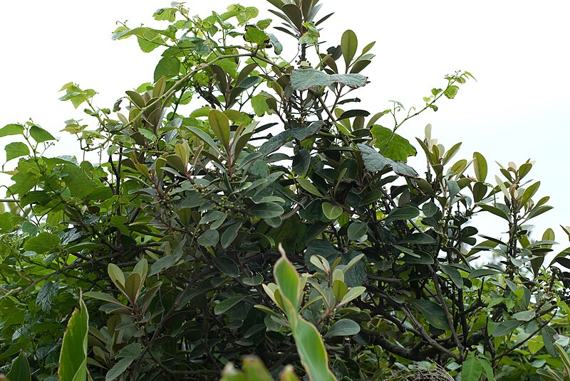
| Description山欖.jpg | English: Planchonella obovata. Tiếng Việt: Chỏi ven biển. 中文:山欖. | ||
| Date | |||
| Source | originally posted to Flickr as 山欖 | ||
| Author | Shih-Shiuan Kao | ||
| Permission (Reusing this file) |
|
| Camera location | 25° 13′ 43.26″ N, 121° 39′ 00.54″ E [REDACTED] | View this and other nearby images on: OpenStreetMap |
|---|
Captions
Add a one-line explanation of what this file representsItems portrayed in this file
depicts
copyright status<\/a>"}},"text\/plain":{"en":{"":"copyright status"}}},"{\"value\":{\"entity-type\":\"item\",\"numeric-id\":50423863,\"id\":\"Q50423863\"},\"type\":\"wikibase-entityid\"}":{"text\/html":{"en":{"P6216":"copyrighted<\/a>"}},"text\/plain":{"en":{"P6216":"copyrighted"}}}}">copyright status
copyrighted
copyright license<\/a>"}},"text\/plain":{"en":{"":"copyright license"}}},"{\"value\":{\"entity-type\":\"item\",\"numeric-id\":19068220,\"id\":\"Q19068220\"},\"type\":\"wikibase-entityid\"}":{"text\/html":{"en":{"P275":"Creative Commons Attribution-ShareAlike 2.0 Generic<\/a>"}},"text\/plain":{"en":{"P275":"Creative Commons Attribution-ShareAlike 2.0 Generic"}}}}">copyright license
Creative Commons Attribution-ShareAlike 2.0 Generic
inception<\/a>"}},"text\/plain":{"en":{"":"inception"}}},"{\"value\":{\"time\":\"+2010-05-08T00:00:00Z\",\"timezone\":0,\"before\":0,\"after\":0,\"precision\":11,\"calendarmodel\":\"http:\\\/\\\/www.wikidata.org\\\/entity\\\/Q1985727\"},\"type\":\"time\"}":{"text\/html":{"en":{"P571":"8 May 2010"}},"text\/plain":{"en":{"P571":"8 May 2010"}}}}">inception
8 May 2010
coordinates of the point of view<\/a>"}},"text\/plain":{"en":{"":"coordinates of the point of view"}}},"{\"value\":{\"latitude\":25.228682,\"longitude\":121.65015,\"altitude\":null,\"precision\":1.0e-6,\"globe\":\"http:\\\/\\\/www.wikidata.org\\\/entity\\\/Q2\"},\"type\":\"globecoordinate\"}":{"text\/html":{"en":{"P1259":"25\u00b013'43.255"N, 121\u00b039'0.540"E"}},"text\/plain":{"en":{"P1259":"25\u00b013'43.255\"N, 121\u00b039'0.540\"E"}}}}">coordinates of the point of view
25°13'43.255"N, 121°39'0.540"E
captured with<\/a>"}},"text\/plain":{"en":{"":"captured with"}}},"{\"value\":{\"entity-type\":\"item\",\"numeric-id\":1063853,\"id\":\"Q1063853\"},\"type\":\"wikibase-entityid\"}":{"text\/html":{"en":{"P4082":"Nikon D80<\/a>"}},"text\/plain":{"en":{"P4082":"Nikon D80"}}}}">captured with
Nikon D80
data size<\/a>"}},"text\/plain":{"en":{"":"data size"}}},"{\"value\":{\"amount\":\"+6095556\",\"unit\":\"http:\\\/\\\/www.wikidata.org\\\/entity\\\/Q8799\"},\"type\":\"quantity\"}":{"text\/html":{"en":{"P3575":"6,095,556 byte<\/span>"}},"text\/plain":{"en":{"P3575":"6,095,556 byte"}}}}">data size
6,095,556 byte
height<\/a>"}},"text\/plain":{"en":{"":"height"}}},"{\"value\":{\"amount\":\"+2592\",\"unit\":\"http:\\\/\\\/www.wikidata.org\\\/entity\\\/Q355198\"},\"type\":\"quantity\"}":{"text\/html":{"en":{"P2048":"2,592 pixel<\/span>"}},"text\/plain":{"en":{"P2048":"2,592 pixel"}}}}">height
2,592 pixel
width<\/a>"}},"text\/plain":{"en":{"":"width"}}},"{\"value\":{\"amount\":\"+3872\",\"unit\":\"http:\\\/\\\/www.wikidata.org\\\/entity\\\/Q355198\"},\"type\":\"quantity\"}":{"text\/html":{"en":{"P2049":"3,872 pixel<\/span>"}},"text\/plain":{"en":{"P2049":"3,872 pixel"}}}}">width
3,872 pixel
media type<\/a>"}},"text\/plain":{"en":{"":"media type"}}},"{\"value\":\"image\\\/jpeg\",\"type\":\"string\"}":{"text\/html":{"en":{"P1163":"image\/jpeg"}},"text\/plain":{"en":{"P1163":"image\/jpeg"}}}}">media type
image/jpeg
checksum<\/a>"}},"text\/plain":{"en":{"":"checksum"}}},"{\"value\":\"a8bddf6d5b8e57cb19a440d5d175ac8dd9ef4e3f\",\"type\":\"string\"}":{"text\/html":{"en":{"P4092":"a8bddf6d5b8e57cb19a440d5d175ac8dd9ef4e3f"}},"text\/plain":{"en":{"P4092":"a8bddf6d5b8e57cb19a440d5d175ac8dd9ef4e3f"}}},"{\"value\":{\"entity-type\":\"property\",\"numeric-id\":459,\"id\":\"P459\"},\"type\":\"wikibase-entityid\"}":{"text\/html":{"en":{"":"determination method or standard<\/a>"}},"text\/plain":{"en":{"":"determination method or standard"}}},"{\"value\":{\"entity-type\":\"item\",\"numeric-id\":13414952,\"id\":\"Q13414952\"},\"type\":\"wikibase-entityid\"}":{"text\/html":{"en":{"P459":"SHA-1<\/a>"}},"text\/plain":{"en":{"P459":"SHA-1"}}}}">checksum
a8bddf6d5b8e57cb19a440d5d175ac8dd9ef4e3f
determination method or standard: SHA-1exposure time<\/a>"}},"text\/plain":{"en":{"":"exposure time"}}},"{\"value\":{\"amount\":\"+0.004\",\"unit\":\"http:\\\/\\\/www.wikidata.org\\\/entity\\\/Q11574\"},\"type\":\"quantity\"}":{"text\/html":{"en":{"P6757":"0.004 second<\/span>"}},"text\/plain":{"en":{"P6757":"0.004 second"}}}}">exposure time
0.004 second
f-number<\/a>"}},"text\/plain":{"en":{"":"f-number"}}},"{\"value\":{\"amount\":\"+6.3\",\"unit\":\"1\"},\"type\":\"quantity\"}":{"text\/html":{"en":{"P6790":"6.3"}},"text\/plain":{"en":{"P6790":"6.3"}}}}">f-number
6.3
ISO speed<\/a>"}},"text\/plain":{"en":{"":"ISO speed"}}},"{\"value\":{\"amount\":\"+320\",\"unit\":\"1\"},\"type\":\"quantity\"}":{"text\/html":{"en":{"P6789":"320"}},"text\/plain":{"en":{"P6789":"320"}}}}">ISO speed
320
instance of<\/a>"}},"text\/plain":{"en":{"":"instance of"}}},"{\"value\":{\"entity-type\":\"item\",\"numeric-id\":125191,\"id\":\"Q125191\"},\"type\":\"wikibase-entityid\"}":{"text\/html":{"en":{"P31":"photograph<\/a>"}},"text\/plain":{"en":{"P31":"photograph"}}}}">instance of
photograph
focal length<\/a>"}},"text\/plain":{"en":{"":"focal length"}}},"{\"value\":{\"amount\":\"+60\",\"unit\":\"http:\\\/\\\/www.wikidata.org\\\/entity\\\/Q174789\"},\"type\":\"quantity\"}":{"text\/html":{"en":{"P2151":"60 millimetre<\/span>"}},"text\/plain":{"en":{"P2151":"60 millimetre"}}}}">focal length
60 millimetre
File history
Click on a date/time to view the file as it appeared at that time.
| Date/Time | Thumbnail | Dimensions | User | Comment | |
|---|---|---|---|---|---|
| current | 06:53, 14 July 2010 |  | 3,872 × 2,592 (5.81 MB) | Flickr upload bot | Uploaded from http://flickr.com/photo/79319797@N00/4601190762 using Flickr upload bot |
File usage
The following 2 pages use this file:
Global file usage
The following other wikis use this file:
- Usage on ceb.wikipedia.org
- Usage on ilo.wikipedia.org
- Usage on ms.wikipedia.org
- Usage on sv.wikipedia.org
- Usage on vi.wikipedia.org
- Usage on war.wikipedia.org
- Usage on zh.wikipedia.org
Metadata
This file contains additional information, probably added from the digital camera or scanner used to create or digitize it.
If the file has been modified from its original state, some details may not fully reflect the modified file.
| Camera manufacturer | NIKON CORPORATION |
|---|---|
| Camera model | NIKON D80 |
| Exposure time | 1/250 sec (0.004) |
| F-number | f/6.3 |
| ISO speed rating | 320 |
| Date and time of data generation | 11:39, 8 May 2010 |
| Lens focal length | 60 mm |
| Altitude | 69.233 meters above sea level |
| Horizontal resolution | 240 dpi |
| Vertical resolution | 240 dpi |
| Software used | Ver.1.01 |
| File change date and time | 01:51, 12 May 2010 |
| Exposure Program | Manual |
| Exif version | 2.21 |
| Date and time of digitizing | 11:39, 8 May 2010 |
| Shutter speed | 7.965784 |
| APEX aperture | 5.310704 |
| Exposure bias | 0 |
| Maximum land aperture | 3 APEX (f/2.83) |
| Subject distance | 2 meters |
| Metering mode | Pattern |
| Light source | Unknown |
| Flash | Flash did not fire |
| Sensing method | One-chip color area sensor |
| Custom image processing | Normal process |
| Exposure mode | Manual exposure |
| White balance | Manual white balance |
| Digital zoom ratio | 1 |
| Focal length in 35 mm film | 90 mm |
| Scene capture type | Standard |
| Contrast | Normal |
| Saturation | Normal |
| Sharpness | Normal |
| Subject distance range | Unknown |
| North or south latitude | North latitude |
| East or west longitude | East longitude |
| Speed unit | Kilometers per hour |
| Speed of GPS receiver | 2.1 |
| Geodetic survey data used | WGS-84 |
| GPS date | 2010-05-08 |