 Size of this preview: 600 × 599 pixels. Other resolutions: 240 × 240 pixels | 481 × 480 pixels | 769 × 768 pixels | 1,026 × 1,024 pixels | 1,306 × 1,304 pixels.
Original file (1,306 × 1,304 pixels, file size: 370 KB, MIME type: image/jpeg)
| This is a file from the Wikimedia Commons. Information from its description page there is shown below. Commons is a freely licensed media file repository. You can help. |
Summary
| Description(Barbate) Strait of Gibraltar, Mediterranean Sea (cropped).jpg |
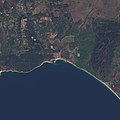
English: Observational Data courtesy of Landsat 8 satellite (Bands: 2, 3, 4, 8) & USGS. Data processed by Paul Quast.
Data Specifications: Coordinates: 36.0208, -5.1121. Acquired: 17-Jan-2017 (Entity ID: LC82010352017017LGN00, Path: 201, Row: 35). Features of interest: Gibraltar . Tangier, Morocco . Malaga, Spain . Parque Natural Los Alcomocales . |
|||
| Date | ||||
| Source | https://www.flickr.com/photos/148318224@N03/34540745262/ | |||
| Author | O.V.E.R.V.I.E.W. | |||
| Other versions |
|
| Camera location | 36° 02′ 32.77″ N, 5° 09′ 19.2″ W | View this and other nearby images on: OpenStreetMap |
|---|
Licensing
- You are free:
- to share – to copy, distribute and transmit the work
- to remix – to adapt the work
- Under the following conditions:
- attribution – You must give appropriate credit, provide a link to the license, and indicate if changes were made. You may do so in any reasonable manner, but not in any way that suggests the licensor endorses you or your use.
Captions
Add a one-line explanation of what this file representsItems portrayed in this file
depicts
copyright status<\/a>"}},"text\/plain":{"en":{"":"copyright status"}}},"{\"value\":{\"entity-type\":\"item\",\"numeric-id\":50423863,\"id\":\"Q50423863\"},\"type\":\"wikibase-entityid\"}":{"text\/html":{"en":{"P6216":"copyrighted<\/a>"}},"text\/plain":{"en":{"P6216":"copyrighted"}}}}">copyright status
copyrighted
copyright license<\/a>"}},"text\/plain":{"en":{"":"copyright license"}}},"{\"value\":{\"entity-type\":\"item\",\"numeric-id\":19125117,\"id\":\"Q19125117\"},\"type\":\"wikibase-entityid\"}":{"text\/html":{"en":{"P275":"Creative Commons Attribution 2.0 Generic<\/a>"}},"text\/plain":{"en":{"P275":"Creative Commons Attribution 2.0 Generic"}}}}">copyright license
Creative Commons Attribution 2.0 Generic
coordinates of the point of view<\/a>"}},"text\/plain":{"en":{"":"coordinates of the point of view"}}},"{\"value\":{\"latitude\":36.042436,\"longitude\":-5.155334,\"altitude\":null,\"precision\":1.0e-6,\"globe\":\"http:\\\/\\\/www.wikidata.org\\\/entity\\\/Q2\"},\"type\":\"globecoordinate\"}":{"text\/html":{"en":{"P1259":"36\u00b02'32.770"N, 5\u00b09'19.202"W"}},"text\/plain":{"en":{"P1259":"36\u00b02'32.770\"N, 5\u00b09'19.202\"W"}}}}">coordinates of the point of view
36°2'32.770"N, 5°9'19.202"W
inception<\/a>"}},"text\/plain":{"en":{"":"inception"}}},"{\"value\":{\"time\":\"+2017-05-04T00:00:00Z\",\"timezone\":0,\"before\":0,\"after\":0,\"precision\":11,\"calendarmodel\":\"http:\\\/\\\/www.wikidata.org\\\/entity\\\/Q1985727\"},\"type\":\"time\"}":{"text\/html":{"en":{"P571":"4 May 2017"}},"text\/plain":{"en":{"P571":"4 May 2017"}}}}">inception
4 May 2017
media type<\/a>"}},"text\/plain":{"en":{"":"media type"}}},"{\"value\":\"image\\\/jpeg\",\"type\":\"string\"}":{"text\/html":{"en":{"P1163":"image\/jpeg"}},"text\/plain":{"en":{"P1163":"image\/jpeg"}}}}">media type
image/jpeg
checksum<\/a>"}},"text\/plain":{"en":{"":"checksum"}}},"{\"value\":\"61d0801723903ab7155b96038dac47be94abe68a\",\"type\":\"string\"}":{"text\/html":{"en":{"P4092":"61d0801723903ab7155b96038dac47be94abe68a"}},"text\/plain":{"en":{"P4092":"61d0801723903ab7155b96038dac47be94abe68a"}}},"{\"value\":{\"entity-type\":\"property\",\"numeric-id\":459,\"id\":\"P459\"},\"type\":\"wikibase-entityid\"}":{"text\/html":{"en":{"":"determination method or standard<\/a>"}},"text\/plain":{"en":{"":"determination method or standard"}}},"{\"value\":{\"entity-type\":\"item\",\"numeric-id\":13414952,\"id\":\"Q13414952\"},\"type\":\"wikibase-entityid\"}":{"text\/html":{"en":{"P459":"SHA-1<\/a>"}},"text\/plain":{"en":{"P459":"SHA-1"}}}}">checksum
61d0801723903ab7155b96038dac47be94abe68a
determination method or standard: SHA-1data size<\/a>"}},"text\/plain":{"en":{"":"data size"}}},"{\"value\":{\"amount\":\"+378625\",\"unit\":\"http:\\\/\\\/www.wikidata.org\\\/entity\\\/Q8799\"},\"type\":\"quantity\"}":{"text\/html":{"en":{"P3575":"378,625 byte<\/span>"}},"text\/plain":{"en":{"P3575":"378,625 byte"}}}}">data size
378,625 byte
height<\/a>"}},"text\/plain":{"en":{"":"height"}}},"{\"value\":{\"amount\":\"+1304\",\"unit\":\"http:\\\/\\\/www.wikidata.org\\\/entity\\\/Q355198\"},\"type\":\"quantity\"}":{"text\/html":{"en":{"P2048":"1,304 pixel<\/span>"}},"text\/plain":{"en":{"P2048":"1,304 pixel"}}}}">height
1,304 pixel
width<\/a>"}},"text\/plain":{"en":{"":"width"}}},"{\"value\":{\"amount\":\"+1306\",\"unit\":\"http:\\\/\\\/www.wikidata.org\\\/entity\\\/Q355198\"},\"type\":\"quantity\"}":{"text\/html":{"en":{"P2049":"1,306 pixel<\/span>"}},"text\/plain":{"en":{"P2049":"1,306 pixel"}}}}">width
1,306 pixel
File history
Click on a date/time to view the file as it appeared at that time.
| Date/Time | Thumbnail | Dimensions | User | Comment | |
|---|---|---|---|---|---|
| current | 09:24, 6 September 2020 |  | 1,306 × 1,304 (370 KB) | Up and Go | File:Strait of Gibraltar, Mediterranean Sea.jpg cropped 90 % horizontally, 90 % vertically using CropTool with lossless mode. |
File usage
The following page uses this file:
Metadata
This file contains additional information, probably added from the digital camera or scanner used to create or digitize it.
If the file has been modified from its original state, some details may not fully reflect the modified file.
| Orientation | Normal |
|---|---|
| Horizontal resolution | 72 dpi |
| Vertical resolution | 72 dpi |
| Software used | Adobe Photoshop CS5 Windows |
| File change date and time | 20:12, 16 May 2017 |
| Color space | sRGB |
| Date and time of digitizing | 12:47, 4 May 2017 |
| Date metadata was last modified | 21:12, 16 May 2017 |
| Unique ID of original document | xmp.did:B9E4DE19B730E7119901836F365B18E4 |
| IIM version | 33,984 |
