Map all coordinates using OpenStreetMap
Download coordinates as:
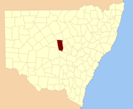
Cadastral in New South Wales, Australia| Flinders New South Wales | |||||||||||||||
|---|---|---|---|---|---|---|---|---|---|---|---|---|---|---|---|
 Location in New South Wales Location in New South Wales | |||||||||||||||
| |||||||||||||||
Flinders County is one of the 141 cadastral divisions of New South Wales. It is located to the south west of the Bogan River.
Flinders County was named in honour of the navigator, hydrographer, and scientist Matthew Flinders (1774-1814).
The topography is generally flat and the climate has a Koppen Climate Classification of BsK (Hot semi arid).

The only town of the Parish is Nyngan, which is the seat of local government. The Village of Hermidale is located on the highway which forms the northern border of the country.
Parishes within this county
A full list of parishes found within this county; their current LGA and mapping coordinates to the approximate centre of each location is as follows:
References
- "Flinders County". Geographical Names Register (GNR) of NSW. Geographical Names Board of New South Wales.
