| Fornells de Mar | |
|---|---|
| Village, bay and port | |
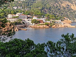
 The village of Fornells viewed across the bay of Aiguablava The village of Fornells viewed across the bay of Aiguablava | |
   | |
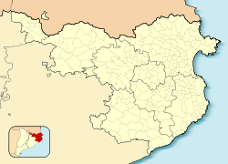
| Coordinates: 41°56′15.36″N 3°12′57.60″E / 41.9376000°N 3.2160000°E / 41.9376000; 3.2160000 | |
| Country | Spain |
| Autonomous community | Catalonia |
| Province | Girona |
| Comarca | Baix Empordà |
| Municipality | Begur |
| Elevation | 0 m (0 ft) |
Fornells de Mar (zipcode 17255), also known as Platja de Fornells or simply Fornells, is a village, bay and port on the Costa Brava and in the municipality of Begur, Catalonia, Spain. It lies between Sa Tuna [ca] and Tamariu. It was formerly mainly a fishing village and there is still some fishing activity.
Fornells is the site of the Port d'Aiguablava, a marina with 61 moorings operated by the Club Nàutic Aiguablava. Within Fornells itself there are, from north to south, the larger beach of Platja Fonda, and the smaller coves of Cala n’Estasia, Cala Port de ses Orats, Cala d’en Malaret and Cala Port d’Esclanyà. Further to the south lies the beach of Cala d'Aiguablava. There are several hotels in Fornells village, including the large Hotel Aigua Blava.
The GR 92 long distance footpath, which runs the length of the Mediterranean coast of Spain, passes through the village. To the north the path follows the incised coastline to near Platja Fonda before heading inland towards Sa Tuna [ca] and Begur. To the south it follows the coastline to the beach at Aiguablava before following an inland route through pine and cork oak forests to the resort of Tamariu.
The Torras i Arruga family has several luxury estates around the Platja Fonda.
Gallery
-
 The shoreline
-
The marina
-
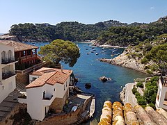
 The bay of Aiguablava viewed from the village
-
 The village viewed from above
-
 The village beach
References
- Joel Stratte-McClure - The Idiot and the Odyssey: Walking the Mediterranean 2008 0977586650 "A stone path leads to the Fishing and Biodiversity Marine Reserve in Ses Negres and beyond that to the delightful whitewashed villages of Sa Riera, Aiguafreda, Sa Tuna, Fornells de Mar, Aigua Blava, Tamariu, Llafranc and Calella de ..."
- Cinco historias del mar 8423351246 Josep Pla - 2016 "Por entonces, querido amigo, vivíamos en Fornells —no en el Fornells de Menorca, que es un sitio destemplado y árido, sino en el Fornells de nuestro país, que es abrigado y dulcísimo—. Luego de tanto vagabundear por el mundo y de ..."
- ^ Empordà Costa Brava - Sud (Map). 1:30,000. Editorial PIOLET i Consell Comarcal del Baix Empordà. March 2012.
- "Port d'Aiguablava". www.catalunya.com. Archived from the original on 5 November 2022. Retrieved 5 November 2022.
- "Fornells". Visit Begur. Archived from the original on 5 November 2022. Retrieved 5 November 2022.
This Province of Girona location article is a stub. You can help Misplaced Pages by expanding it. |