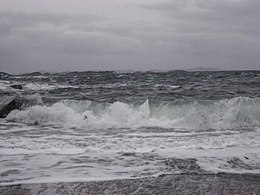
 Waves breaking on the northern shore of the island Waves breaking on the northern shore of the island | |
| Geography | |
|---|---|
| Location | Trøndelag, Norway |
| Coordinates | 64°57′06″N 11°25′46″E / 64.95168°N 11.42938°E / 64.95168; 11.42938 |
| Area | 5.5 km (2.1 sq mi) |
| Length | 3.6 km (2.24 mi) |
| Width | 2.4 km (1.49 mi) |
| Highest elevation | 117 m (384 ft) |
| Highest point | Øyrshatten |
| Administration | |
| Norway | |
| County | Trøndelag |
| Municipality | Nærøysund Municipality |
| Demographics | |
| Population | 20 |
| Pop. density | 3.6/km (9.3/sq mi) |
Gjerdinga is an island in Nærøysund Municipality in Trøndelag county, Norway. The island lies at the northern end of the Nærøysundet. Most of the 20 residents of the island live in the village of Gjerdinga on the southeastern part of the island. The island is connected to the mainland by a ferry operated by Namsos Trafikkselskap. The ferry goes between Sæla (on the island) and Eidshaug (on Kvingra on the mainland) six times per day.
References
- "Informasjon om stadnamn". Norgeskart (in Norwegian). Kartverket. Retrieved 2024-11-07.
- "Gjerdinga" (in Norwegian). yr.no. Retrieved 2011-09-28.
This article about an island in Trøndelag is a stub. You can help Misplaced Pages by expanding it. |