Name
Location
Type
Completed Date designated
Grid ref. Entry number Image
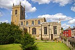
Parish Church of St Mary
Doddington , FenlandParish Church
Mid 13th century
25 October 1951
TL4001990557 52°29′42″N 0°03′40″E / 52.494955°N 0.061038°E / 52.494955; 0.061038 (Parish Church of St Mary)
1126575 Parish Church of St Mary More images
Elm House
Elm , FenlandHouse
c. 1630
23 June 1952
TF4711407012 52°38′27″N 0°10′22″E / 52.640911°N 0.172763°E / 52.640911; 0.172763 (Elm House)
1125941 Upload Photo
Park House
Leverington , FenlandHouse
slightly earlier
23 June 1952
TF4356211995 52°41′12″N 0°07′21″E / 52.686626°N 0.122476°E / 52.686626; 0.122476 (Park House)
1310313 Upload Photo
Norland House
March , FenlandApartment
1985
22 February 1985
TL4166796200 52°32′43″N 0°05′16″E / 52.545226°N 0.087698°E / 52.545226; 0.087698 (Norland House)
1216221 Upload Photo
38 West End
March, Fenland
House
1626
13 March 1951
TL4136396820 52°33′03″N 0°05′01″E / 52.550875°N 0.083482°E / 52.550875; 0.083482 (38 West End)
1366042 Upload Photo
Church of St James
Newton-in-the-Isle , FenlandParish Church
13th century
23 June 1952
TF4402814811 52°42′42″N 0°07′50″E / 52.7118°N 0.130597°E / 52.7118; 0.130597 (Church of St James)
1125956 Church of St James More images
Church of St John the Baptist
Parson Drove , FenlandChurch
Late 12th century
23 June 1952
TF3903009088 52°39′42″N 0°03′15″E / 52.661691°N 0.05425°E / 52.661691; 0.05425 (Church of St John the Baptist)
1331998 Church of St John the Baptist More images
Church of St Giles
Tydd St. Giles , FenlandParish Church
Late 12th century
23 June 1952
TF4270716472 52°43′37″N 0°06′42″E / 52.727071°N 0.111777°E / 52.727071; 0.111777 (Church of St Giles)
1125926 Church of St Giles More images
Church of St Andrew
Whittlesey , FenlandParish Church
13th century
11 August 1950
TL2667396919 52°33′19″N 0°07′59″W / 52.555378°N 0.133005°W / 52.555378; -0.133005 (Church of St Andrew)
1227881 Church of St Andrew More images
Grove House
Whittlesey, Fenland
House
c. 1680
11 August 1950
TL2684696771 52°33′14″N 0°07′50″W / 52.554008°N 0.130512°W / 52.554008; -0.130512 (Grove House)
1216541 Grove House
Market Cross
Whittlesey, Fenland
Market Cross
Late 17th century
11 August 1950
TL2703197043 52°33′23″N 0°07′40″W / 52.556408°N 0.12768°W / 52.556408; -0.12768 (Market Cross)
1287355 Market Cross More images
Post Office
Whittlesey, Fenland
House
Late 18th century
31 July 1970
TL2702397006 52°33′22″N 0°07′40″W / 52.556078°N 0.127813°W / 52.556078; -0.127813 (Post Office)
1228131 Upload Photo
Vinpenta House
Whittlesey, Fenland
House
c. 1740
11 August 1950
TL2707997074 52°33′24″N 0°07′37″W / 52.556676°N 0.126961°W / 52.556676; -0.126961 (Vinpenta House)
1287392 Upload Photo
Wilderness House
Whittlesey, Fenland
House
Early 18th century
11 August 1950
TL2671196933 52°33′20″N 0°07′57″W / 52.555495°N 0.13244°W / 52.555495; -0.13244 (Wilderness House)
1287350 Upload Photo
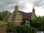
North House
Wimblington , FenlandHouse
Late 17th century or early 18th century
25 October 1951
TL4153092145 52°30′32″N 0°05′02″E / 52.508832°N 0.083954°E / 52.508832; 0.083954 (North House)
1161423 North House
Clarkson Memorial
Wisbech , FenlandStatue
1880
10 February 1969
TF4606309627 52°39′53″N 0°09′30″E / 52.664686°N 0.158399°E / 52.664686; 0.158399 (Clarkson Memorial)
1228597 Clarkson Memorial More images
Dicken's Tavern
Wisbech, Fenland
House
Mid 18th century
10 February 1969
TF4619509787 52°39′58″N 0°09′38″E / 52.666087°N 0.160421°E / 52.666087; 0.160421 (Dicken's Tavern)
1228928 Upload Photo
Empire Cinema
Wisbech, Fenland
Cinema
1932
31 October 1983
TF4632809744 52°39′56″N 0°09′45″E / 52.665665°N 0.162367°E / 52.665665; 0.162367 (Empire Cinema)
1125906 Empire Cinema
Horace Friend Warehouse Number 2
Wisbech, Fenland
Prison
Early 19th century
10 February 1969
TF4610709744 52°39′57″N 0°09′33″E / 52.665725°N 0.159101°E / 52.665725; 0.159101 (Horace Friend Warehouse Number 2)
1126629 Horace Friend Warehouse Number 2
Octavia Hill Birthplace Museum
Wisbech, Fenland
House
c. 1740
31 October 1983
TF4595909608 52°39′52″N 0°09′25″E / 52.664543°N 0.156854°E / 52.664543; 0.156854 (Octavia Hill Birthplace Museum)
1126599 Octavia Hill Birthplace Museum More images
Oldham Chemists
Wisbech, Fenland
Shop
Late 18th century
31 October 1983
TF4618109715 52°39′56″N 0°09′37″E / 52.665444°N 0.160182°E / 52.665444; 0.160182 (Oldham Chemists)
1126657 Upload Photo
Former Queen's Hotel
Wisbech, Fenland
House
Early to mid 18th century
31 October 1983
TF4588709577 52°39′51″N 0°09′21″E / 52.664284°N 0.155777°E / 52.664284; 0.155777 (Former Queen's Hotel)
1278862 Former Queen's Hotel More images
Queen's School
Wisbech, Fenland
House
Mid 18th century
31 October 1983
TF4586509564 52°39′51″N 0°09′20″E / 52.664173°N 0.155446°E / 52.664173; 0.155446 (Queen's School)
1229902 Upload Photo
Stable to North West of No 15 (Peckover House)
Wisbech, Fenland
Tack Room
Mid to late 18th century
10 February 1969
TF4581109658 52°39′54″N 0°09′17″E / 52.665032°N 0.15469°E / 52.665032; 0.15469 (Stable to North West of No 15 (Peckover House))
1126639 Stable to North West of No 15 (Peckover House)
The Castle
Wisbech, Fenland
Villa
1816
31 October 1983
TF4622009565 52°39′51″N 0°09′38″E / 52.664086°N 0.160692°E / 52.664086; 0.160692 (The Castle)
1229170 The Castle More images
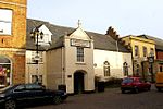
The Conservative Club
Wisbech, Fenland
Guildhall
c. 1379
31 October 1983
TF4621009759 52°39′57″N 0°09′38″E / 52.665832°N 0.16063°E / 52.665832; 0.16063 (The Conservative Club)
1126681 The Conservative Club More images
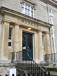
The Museum
Wisbech, Fenland
Museum
1846-7
10 February 1969
TF4626009567 52°39′51″N 0°09′41″E / 52.664094°N 0.161284°E / 52.664094; 0.161284 (The Museum)
1126669 The Museum More images
The Rose and Crown Inn
Wisbech, Fenland
Courtyard
Early 17th century
31 October 1983
TF4614209706 52°39′55″N 0°09′35″E / 52.665374°N 0.159602°E / 52.665374; 0.159602 (The Rose and Crown Inn)
1126656 The Rose and Crown Inn More images
12 North Street
Wisbech, Fenland
House
Late 18th century
19 November 1976
TF4604109840 52°40′00″N 0°09′29″E / 52.666605°N 0.158169°E / 52.666605; 0.158169 (12 North Street)
1126622 12 North Street
1 and 2 Old Market
Wisbech, Fenland
House
Late 18th century
31 October 1983
TF4605509809 52°39′59″N 0°09′30″E / 52.666323°N 0.158362°E / 52.666323; 0.158362 (1 and 2 Old Market)
1229806 Upload Photo
8 and 9 Old Market
Wisbech, Fenland
House
Second half 18th century
10 February 1969
TF4604009761 52°39′57″N 0°09′29″E / 52.665896°N 0.158119°E / 52.665896; 0.158119 (8 and 9 Old Market)
1126590 Upload Photo
32 Old Market
Wisbech, Fenland
House
1723
31 October 1983
TF4597809801 52°39′59″N 0°09′26″E / 52.666272°N 0.15722°E / 52.666272; 0.15722 (32 Old Market)
1126595 32 Old Market
6 North Brink
Wisbech, Fenland
House
Early 18th century
31 October 1983
TF4593709682 52°39′55″N 0°09′24″E / 52.665214°N 0.156562°E / 52.665214; 0.156562 (6 North Brink)
1279135 6 North Brink
7 North Brink
Wisbech, Fenland
House
c. 1747
31 October 1983
TF4593009678 52°39′55″N 0°09′23″E / 52.66518°N 0.156457°E / 52.66518; 0.156457 (7 North Brink)
1126635 7 North Brink
8 and 9 North Brink
Wisbech, Fenland
House
Late 18th century
31 October 1983
TF4592209676 52°39′55″N 0°09′23″E / 52.665164°N 0.156338°E / 52.665164; 0.156338 (8 and 9 North Brink)
1279141 8 and 9 North Brink
12 North Brink
Wisbech, Fenland
House
Early 18th century
31 October 1983
TF4588609670 52°39′54″N 0°09′21″E / 52.665119°N 0.155803°E / 52.665119; 0.155803 (12 North Brink)
1126637 Upload Photo
19 North Brink
Wisbech, Fenland
House
1983
31 October 1983
TF4583409642 52°39′54″N 0°09′18″E / 52.664882°N 0.155022°E / 52.664882; 0.155022 (19 North Brink)
1279125 Upload Photo
6 The Crescent
Wisbech, Fenland
Terraced House
c. 1793
31 October 1983
TF4619209529 52°39′50″N 0°09′37″E / 52.66377°N 0.160262°E / 52.66377; 0.160262 (6 The Crescent)
1331608 Upload Photo
3 School Lane
Wisbech, Fenland
Town House
1701
31 October 1983
TF4616409816 52°39′59″N 0°09′36″E / 52.666356°N 0.159975°E / 52.666356; 0.159975 (3 School Lane)
1331650 Upload Photo
Chapel of Ease
Guyhirn, Wisbech St. Mary , Fenland
Chapel of Ease
1983
23 June 1952
TF4014003785 52°36′50″N 0°04′06″E / 52.613764°N 0.068402°E / 52.613764; 0.068402 (Chapel of Ease)
1331986 Chapel of Ease More images
Church of St Mary
Wisbech St. Mary, Fenland
Parish Church
14th century
23 June 1952
TF4197108142 52°39′09″N 0°05′50″E / 52.652431°N 0.097297°E / 52.652431; 0.097297 (Church of St Mary)
1161226 Church of St Mary More images
The Manor House
Wisbech St. Mary, Fenland
House
1791
23 June 1952
TF4208508817 52°39′30″N 0°05′57″E / 52.658465°N 0.099271°E / 52.658465; 0.099271 (The Manor House)
1125899 The Manor House More images


