Name
Location
Type
Completed Date designated
Grid ref. Entry number Image
Church of All Saints
Allhallows , MedwayParish Church
12th century
21 November 1966
TQ8359777547 51°28′02″N 0°38′31″E / 51.467105°N 0.641842°E / 51.467105; 0.641842 (Church of All Saints)
1085758 Church of All Saints More images
Church of St Helen
Cliffe and Cliffe Woods , MedwayCollegiate Church
c. 1200
21 November 1966
TQ7359476626 51°27′43″N 0°29′51″E / 51.461986°N 0.497529°E / 51.461986; 0.497529 (Church of St Helen)
1204042 Church of St Helen More images
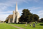
Church of St James
Cooling , MedwayParish Church
C13-C15
21 November 1966
TQ7562475949 51°27′19″N 0°31′35″E / 51.455279°N 0.526385°E / 51.455279; 0.526385 (Church of St James)
1204117 Church of St James More images
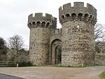
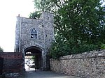
Cooling Castle Gatehouse
Cooling, Medway
Castle
1381-85
21 November 1966
TQ7538775892 51°27′17″N 0°31′23″E / 51.45484°N 0.522949°E / 51.45484; 0.522949 (Cooling Castle Gatehouse)
1085770 Cooling Castle GatehouseMore images
Inner Ward to Cooling Castle
Cooling, Medway
Castle
seat after 1214
21 November 1966
TQ7536875942 51°27′19″N 0°31′22″E / 51.455295°N 0.522701°E / 51.455295; 0.522701 (Inner Ward to Cooling Castle)
1085771 Inner Ward to Cooling Castle More images
Church of St Michael
Cuxton , MedwayParish Church
12th century
21 November 1966
TQ7095966451 51°22′17″N 0°27′17″E / 51.371382°N 0.454733°E / 51.371382; 0.454733 (Church of St Michael)
1085774 Church of St Michael More images
Barn 30 Yards South West of the Manor House
Frindsbury Extra , MedwayAisled Barn
c. 1300
27 August 1952
TQ7469470041 51°24′09″N 0°30′36″E / 51.402495°N 0.510102°E / 51.402495; 0.510102 (Barn 30 Yards South West of the Manor House)
1204320 Barn 30 Yards South West of the Manor House More images
The Barracks
Upnor , Frindsbury Extra, MedwayBarracks
1717-18
14 November 1986
TQ7581070502 51°24′23″N 0°31′35″E / 51.406292°N 0.526358°E / 51.406292; 0.526358 (The Barracks)
1085742 The Barracks More images
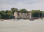
Upnor Castle
Upper Upnor , Frindsbury Extra, MedwayMoat
1599-1601
14 November 1986
TQ7585670574 51°24′25″N 0°31′37″E / 51.406924°N 0.527055°E / 51.406924; 0.527055 (Upnor Castle)
1204365 Upnor Castle More images
Church of St John the Baptist
Halling , MedwayParish Church
12th century
21 November 1966
TQ7052163886 51°20′54″N 0°26′50″E / 51.348471°N 0.447217°E / 51.348471; 0.447217 (Church of St John the Baptist)
1085746 Church of St John the Baptist More images
Church of St Margaret
High Halstow , MedwayParish Church
13th century
21 January 1966
TQ7797675278 51°26′55″N 0°33′36″E / 51.448518°N 0.559864°E / 51.448518; 0.559864 (Church of St Margaret)
1204435 Church of St Margaret More images
Church of St Werburgh
Hoo St. Werburgh , MedwayParish Church
C12-C15
21 November 1966
TQ7834671856 51°25′04″N 0°33′48″E / 51.417663°N 0.563462°E / 51.417663; 0.563462 (Church of St Werburgh)
1204440 Church of St Werburgh More images
Church of St James
Isle of Grain , MedwayParish Church
12th century
21 November 1966
TQ8887476789 51°27′31″N 0°43′02″E / 51.458562°N 0.71732°E / 51.458562; 0.71732 (Church of St James)
1085755 Church of St James More images
Church of St Peter and St Paul
Stoke , MedwayParish Church
12th century
21 November 1966
TQ8234275073 51°26′43″N 0°37′21″E / 51.445288°N 0.62252°E / 51.445288; 0.62252 (Church of St Peter and St Paul)
1204545 Church of St Peter and St Paul More images
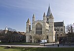
Cathedral Church of Christ and the Blessed Virgin Mary of Rochester
Rochester , MedwayCathedral
C7
24 October 1950
TQ7427368521 51°23′20″N 0°30′12″E / 51.38897°N 0.50331°E / 51.38897; 0.50331 (Cathedral Church of Christ and the Blessed Virgin Mary of Rochester)
1086423 Cathedral Church of Christ and the Blessed Virgin Mary of Rochester More images
Cathedral Cloister Buildings
Rochester, Medway
Wall
Roman
24 October 1950
TQ7425768489 51°23′19″N 0°30′11″E / 51.388688°N 0.503065°E / 51.388688; 0.503065 (Cathedral Cloister Buildings)
1086461 Cathedral Cloister Buildings More images
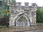
Chertsey's Gate
Rochester, Medway
Gate
Probably mid 14th century
24 October 1950
TQ7429368603 51°23′23″N 0°30′13″E / 51.389701°N 0.503638°E / 51.389701; 0.503638 (Chertsey's Gate)
1086494 Chertsey's Gate More images
Church of St Margaret
Rainham , MedwayChurch
c. 1066
24 February 1950
TQ8173665881 51°21′47″N 0°36′33″E / 51.362918°N 0.609104°E / 51.362918; 0.609104 (Church of St Margaret)
1267793 Church of St Margaret More images
Cloister Gate
Rochester, Medway
Gate
12th century
2 December 1991
TQ7423968480 51°23′19″N 0°30′10″E / 51.388612°N 0.502802°E / 51.388612; 0.502802 (Cloister Gate)
1320354 Cloister Gate More images
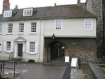
Deanery Gate and Gatehouse
Rochester, Medway
House
Mid-late 18th century
24 October 1950
TQ7429268544 51°23′21″N 0°30′13″E / 51.389171°N 0.503594°E / 51.389171; 0.503594 (Deanery Gate and Gatehouse)
1115637 Deanery Gate and Gatehouse More images
Dickens Chalet to Rear of Eastgate House
Eastgate, Rochester, Medway
Chalet
19th century
24 October 1950
TQ7448068345 51°23′14″N 0°30′22″E / 51.387326°N 0.506196°E / 51.387326; 0.506196 (Dickens Chalet to Rear of Eastgate House)
1116244 Dickens Chalet to Rear of Eastgate House More images
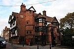
Eastgate House
Eastgate, Rochester, Medway
Jettied House
1590-1
24 October 1950
TQ7447368342 51°23′14″N 0°30′22″E / 51.387301°N 0.506094°E / 51.387301; 0.506094 (Eastgate House)
1086482 Eastgate House More images
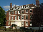
Former Commissioners House and attached Staff Accommodation
Chatham Dockyard, Medway
Naval Officers House
1703
24 May 1971
TQ7587669080 51°23′37″N 0°31′36″E / 51.393498°N 0.526602°E / 51.393498; 0.526602 (Former Commissioners House and attached Staff Accommodation)
1268201 Former Commissioners House and attached Staff Accommodation More images
Former Lead and Paint Mill
Chatham Dockyard, Medway
Paint Factory
1817-1819
13 August 1999
TQ7582368757 51°23′26″N 0°31′32″E / 51.390613°N 0.525681°E / 51.390613; 0.525681 (Former Lead and Paint Mill)
1378588 Former Lead and Paint Mill More images
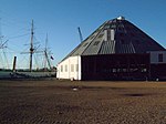
Former Mast House and Mould Loft
Chatham Dockyard, Medway
Mast House
1753-1755
13 August 1999
TQ7602569434 51°23′48″N 0°31′44″E / 51.396631°N 0.528917°E / 51.396631; 0.528917 (Former Mast House and Mould Loft)
1378590 Former Mast House and Mould Loft More images
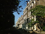
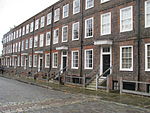
Former Officers Terrace and Attached Front Area Walls and Overthrows
Chatham Dockyard, Medway
Naval Officers House
1722-1731
24 May 1971
TQ7598269154 51°23′39″N 0°31′41″E / 51.39413°N 0.528161°E / 51.39413; 0.528161 (Former Officers Terrace and Attached Front Area Walls and Overthrows)
1268220 Former Officers Terrace and Attached Front Area Walls and Overthrows More images
Former Storehouse Number 2 and Former Rigging Store
Chatham Dockyard, Medway
Rigging House
1793-1796
13 August 1999
TQ7578368951 51°23′33″N 0°31′31″E / 51.392368°N 0.525203°E / 51.392368; 0.525203 (Former Storehouse Number 2 and Former Rigging Store)
1378585 Upload Photo
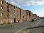
Former Storehouse Number 3 and Former Chain Cable Store
Chatham Dockyard, Medway
Warehouse
1773-1783
13 August 1999
TQ7574268765 51°23′27″N 0°31′28″E / 51.39071°N 0.524522°E / 51.39071; 0.524522 (Former Storehouse Number 3 and Former Chain Cable Store)
1378584 Former Storehouse Number 3 and Former Chain Cable Store More images
Kings School and Cathedral Visitors Centre
Medway
Deanery
Late Medieval
24 October 1950
TQ7431168461 51°23′18″N 0°30′14″E / 51.38842°N 0.503827°E / 51.38842; 0.503827 (Kings School and Cathedral Visitors Centre)
1086421 Upload Photo
Main Gate and attached Dockyard Perimeter Wall to South West
Chatham Dockyard, Medway
Boundary Wall
1718
24 May 1971
TQ7588168888 51°23′30″N 0°31′36″E / 51.391771°N 0.526579°E / 51.391771; 0.526579 (Main Gate and attached Dockyard Perimeter Wall to South West)
1268202 Main Gate and attached Dockyard Perimeter Wall to South West More images
Minor Canons' Row
Medway
Clergy House
1736
24 October 1950
TQ7423568444 51°23′18″N 0°30′10″E / 51.38829°N 0.502727°E / 51.38829; 0.502727 (Minor Canons' Row)
1139023 Minor Canons' Row More images
Number 3 Slip Cover
Chatham Dockyard, Medway
Slip Shed
1838
13 August 1999
TQ7590369410 51°23′47″N 0°31′38″E / 51.396454°N 0.527153°E / 51.396454; 0.527153 (Number 3 Slip Cover)
1378591 Number 3 Slip Cover More images
Number 7 Slip Cover and Machine Shop Number 3
Chatham Dockyard, Medway
Slip Shed
1852-1855
13 August 1999
TQ7599369576 51°23′53″N 0°31′43″E / 51.397917°N 0.528528°E / 51.397917; 0.528528 (Number 7 Slip Cover and Machine Shop Number 3)
1378595 Number 7 Slip Cover and Machine Shop Number 3 More images
Numbers 4 5 and 6 Slip Covers and Machine Shop Number 6
Chatham Dockyard, Medway
Slip Shed
1845-1847
13 August 1999
TQ7595169499 51°23′50″N 0°31′40″E / 51.397238°N 0.527886°E / 51.397238; 0.527886 (Numbers 4 5 and 6 Slip Covers and Machine Shop Number 6)
1378594 Numbers 4 5 and 6 Slip Covers and Machine Shop Number 6 More images
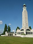
Chatham Naval Memorial
Chatham , Kent War memorial
1924
5 December 1996
TQ7618668049 51°23′01″N 0°31′56″E / 51.383611°N 0.532222°E / 51.383611; 0.532222 (Chatham Naval Memorial)
1267787 Chatham Naval Memorial More images
Parish Church of St Nicholas
Rochester, Medway
Parish Church
1421-23
24 October 1950
TQ7428268570 51°23′22″N 0°30′12″E / 51.389408°N 0.503464°E / 51.389408; 0.503464 (Parish Church of St Nicholas)
1299749 Parish Church of St Nicholas More images
Poor Travellers House / Richard Watts Charity
Medway
House
1950
24 October 1950
TQ7437668495 51°23′19″N 0°30′17″E / 51.388705°N 0.504776°E / 51.388705; 0.504776 (Poor Travellers House / Richard Watts Charity)
1086479 Poor Travellers House / Richard Watts Charity More images
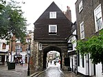
Priors Gate
Rochester, Medway
Gate
1344
24 October 1950
TQ7420468450 51°23′18″N 0°30′08″E / 51.388354°N 0.502285°E / 51.388354; 0.502285 (Priors Gate)
1086428 Priors Gate More images
Public Library (former Corn Exchange) to Rear of High Street, the Corn Exchange the Corn Exchange
Rochester, Medway
Corn Exchange
1706
23 August 1974
TQ7432168655 51°23′25″N 0°30′15″E / 51.390159°N 0.504065°E / 51.390159; 0.504065 (Public Library (former Corn Exchange) to Rear of High Street, the Corn Exchange the Corn Exchange)
1086474 Public Library (former Corn Exchange) to Rear of High Street, the Corn Exchange the Corn Exchange More images
Restoration House including Wall and Gatepiers attached to Front
Medway
Cross Passage House
Late Medieval
24 October 1950
TQ7436368213 51°23′10″N 0°30′16″E / 51.386176°N 0.504451°E / 51.386176; 0.504451 (Restoration House including Wall and Gatepiers attached to Front)
1185341 Restoration House including Wall and Gatepiers attached to FrontMore images
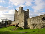
Rochester Castle
Rochester, Medway
Castle
1087-89
24 October 1950
TQ7413768560 51°23′22″N 0°30′05″E / 51.389362°N 0.501377°E / 51.389362; 0.501377 (Rochester Castle)
1336100 Rochester Castle More images
Rochester City Walls
Rochester, Medway
Bastion
Mid 14th century
24 October 1950
TQ7437268345 51°23′14″N 0°30′17″E / 51.387359°N 0.504645°E / 51.387359; 0.504645 (Rochester City Walls)
1086506 Rochester City Walls More images
Sail Loft
Chatham Dockyard, Medway
Sail Loft
c. 1723
13 August 1999
TQ7595169034 51°23′35″N 0°31′40″E / 51.393061°N 0.527656°E / 51.393061; 0.527656 (Sail Loft)
1378586 Sail Loft More images
Section of Roman Wall 20 Metres South of Former Deanery Section of Roman Wall 20 Metres South of Kings School Sixth Form Centre
Medway
Wall
Roman
19 February 1970
TQ7430468430 51°23′17″N 0°30′13″E / 51.388143°N 0.503711°E / 51.388143; 0.503711 (Section of Roman Wall 20 Metres South of Former Deanery Section of Roman Wall 20 Metres South of Kings School Sixth Form Centre)
1336174 Upload Photo
Temple Manor
Strood , MedwayFarmhouse
second and third quarter 17th century
24 October 1950
TQ7331368535 51°23′22″N 0°29′22″E / 51.38939°N 0.489534°E / 51.38939; 0.489534 (Temple Manor)
1120910 Temple Manor More images
The Brunel Saw Mill
Chatham Dockyard, Medway
Fireproof Building
1810-1814
24 May 1971
TQ7617269302 51°23′43″N 0°31′51″E / 51.3954°N 0.530962°E / 51.3954; 0.530962 (The Brunel Saw Mill)
1268231 The Brunel Saw Mill More images
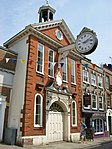
The Guildhall including Ranges Running Parallel to Bull Lane
Rochester, Medway
Local Government Office
1864-66
24 October 1950
TQ7424068741 51°23′27″N 0°30′11″E / 51.390957°N 0.502944°E / 51.390957; 0.502944 (The Guildhall including Ranges Running Parallel to Bull Lane)
1186145 The Guildhall including Ranges Running Parallel to Bull Lane More images
The Ropery and Spinning Room
Chatham Dockyard, Medway
Ropery
1785-1791
24 May 1971
TQ7578768842 51°23′29″N 0°31′31″E / 51.391387°N 0.525206°E / 51.391387; 0.525206 (The Ropery and Spinning Room)
1268250 The Ropery and Spinning Room More images
150, 152 and 154 High Street
Eastgate, Rochester, Medway
Apartment
1950
24 October 1950
TQ7447968299 51°23′13″N 0°30′22″E / 51.386913°N 0.506159°E / 51.386913; 0.506159 (150, 152 and 154 High Street)
1086499 150, 152 and 154 High Street More images


