Name
Location
Type
Completed Date designated
Grid ref. Entry number Image
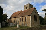
Church of St Margaret
Addington , Tonbridge and Malling Church
c. 1100
25 August 1959
TQ6538558879 51°18′18″N 0°22′16″E / 51.305005°N 0.371214°E / 51.305005; 0.371214 (Church of St Margaret)
1070567 Church of St Margaret More images
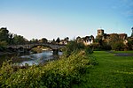
Aylesford Bridge
Aylesford Bridge
14th century
25 August 1959
TQ7294158927 51°18′11″N 0°28′46″E / 51.303192°N 0.479528°E / 51.303192; 0.479528 (Aylesford Bridge)
1363113 Aylesford Bridge More images
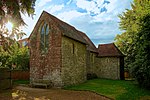
Church of St Peter
Aylesford Church
12th century
25 August 1959
TQ7293959032 51°18′15″N 0°28′46″E / 51.304136°N 0.47955°E / 51.304136; 0.47955 (Church of St Peter)
1337029 Church of St Peter More images
Gatehouse and Walls to the North and East of the Friars
Aylesford Wall
15th century
25 February 1987
TQ7240358930 51°18′12″N 0°28′19″E / 51.303382°N 0.471819°E / 51.303382; 0.471819 (Gatehouse and Walls to the North and East of the Friars)
1111775 Gatehouse and Walls to the North and East of the Friars More images
The Friars, Main Block
Aylesford
Manor House
15th century
25 August 1959
TQ7239658860 51°18′10″N 0°28′18″E / 51.302755°N 0.471685°E / 51.302755; 0.471685 (The Friars, Main Block)
1070570 The Friars, Main Block More images
Church of All Saints
Birling Manor House
Early 14th century
25 August 1959
TQ6801960604 51°19′11″N 0°24′35″E / 51.319731°N 0.409777°E / 51.319731; 0.409777 (Church of All Saints)
1070519 Church of All Saints More images
Church of St Mary the Virgin
Burham Church
C12-C15
25 August 1959
TQ7166062008 51°19′53″N 0°27′46″E / 51.331258°N 0.462652°E / 51.331258; 0.462652 (Church of St Mary the Virgin)
1070523 Church of St Mary the Virgin More images
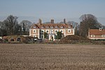
Bradbourne House
East Malling and Larkfield Manor House
17th century
1 August 1952
TQ7036257909 51°17′41″N 0°26′31″E / 51.294824°N 0.442082°E / 51.294824; 0.442082 (Bradbourne House)
1070507 Bradbourne House More images
Church of St James
East Malling and Larkfield
Church
12th century
25 August 1959
TQ7029457080 51°17′15″N 0°26′27″E / 51.287397°N 0.440713°E / 51.287397; 0.440713 (Church of St James)
1099148 Church of St James More images
Clare House
East Malling and Larkfield
House
1793
1 August 1952
TQ6947357736 51°17′37″N 0°25′45″E / 51.293535°N 0.429262°E / 51.293535; 0.429262 (Clare House)
1099100 Upload Photo
Stable Block and Barns 40 Yards North of Bradbourne House
East Malling and Larkfield
Barn
19th century
1 August 1952
TQ7034157965 51°17′43″N 0°26′31″E / 51.295333°N 0.441808°E / 51.295333; 0.441808 (Stable Block and Barns 40 Yards North of Bradbourne House)
1348523 Stable Block and Barns 40 Yards North of Bradbourne House
Barnes Place
Golden Green , Hadlow Kitchen
18th century OR 19th century
20 October 1954
TQ6459248116 51°12′31″N 0°21′18″E / 51.208537°N 0.3549°E / 51.208537; 0.3549 (Barnes Place)
1363161 Upload Photo
Hadlow Castle
Hadlow
House
1951
17 April 1951
TQ6341949639 51°13′21″N 0°20′20″E / 51.222557°N 0.338816°E / 51.222557; 0.338816 (Hadlow Castle)
1070451 Hadlow Castle More images
Church of St Peter
Ightham Church
c. 1400
25 August 1959
TQ5948456930 51°17′21″N 0°17′09″E / 51.289176°N 0.285762°E / 51.289176; 0.285762 (Church of St Peter)
1071962 Church of St Peter More images
Ightham Mote
Ightham
House
At least 1340-1360
1 August 1952
TQ5847653485 51°15′31″N 0°16′11″E / 51.258505°N 0.269792°E / 51.258505; 0.269792 (Ightham Mote)
1362410 Ightham Mote More images
Church of St Lawrence
Mereworth Parish Church
1744-1746
25 August 1959
TQ6601853752 51°15′32″N 0°22′40″E / 51.258759°N 0.377906°E / 51.258759; 0.377906 (Church of St Lawrence)
1186214 Church of St Lawrence More images
Mereworth Castle (main Block)
Mereworth
House
18th century
1 August 1952
TQ6689553230 51°15′14″N 0°23′25″E / 51.253814°N 0.390219°E / 51.253814; 0.390219 (Mereworth Castle (main Block))
1070675 Mereworth Castle (main Block)More images
Pavilion to the North East of Mereworth Castle
Mereworth
Pavilion
Circa 1740-1750
1 August 1952
TQ6694253276 51°15′15″N 0°23′27″E / 51.254213°N 0.390914°E / 51.254213; 0.390914 (Pavilion to the North East of Mereworth Castle)
1363025 Pavilion to the North East of Mereworth Castle
Pavilion to the North West and Stables of Mereworth Castle
Mereworth
Manor House
1740-1750
1 August 1952
TQ6686253285 51°15′16″N 0°23′23″E / 51.254318°N 0.389773°E / 51.254318; 0.389773 (Pavilion to the North West and Stables of Mereworth Castle)
1070676 Pavilion to the North West and Stables of Mereworth Castle
Yotes Court
Mereworth
Country House
1656-1658
19 April 1985
TQ6501553307 51°15′18″N 0°21′48″E / 51.255052°N 0.363339°E / 51.255052; 0.363339 (Yotes Court)
1363026 Yotes Court More images
Church of St Michael
Offham Church
c. 1100
25 August 1959
TQ6602958063 51°17′51″N 0°22′48″E / 51.297486°N 0.380065°E / 51.297486; 0.380065 (Church of St Michael)
1264787 Church of St Michael More images
Fairlawne
Plaxtol Country House
Before 1840
1 August 1952
TQ5943653430 51°15′28″N 0°17′01″E / 51.257743°N 0.283514°E / 51.257743; 0.283514 (Fairlawne)
1072711 Fairlawne More images
Old Soar Manor
Plaxtol
Farmhouse
18th century
3 May 1984
TQ6195054103 51°15′47″N 0°19′11″E / 51.263082°N 0.319816°E / 51.263082; 0.319816 (Old Soar Manor)
1281122 Old Soar Manor More images
Church of All Saints
Snodland Parish Church
12th century
25 August 1959
TQ7076161822 51°19′47″N 0°26′59″E / 51.329857°N 0.449671°E / 51.329857; 0.449671 (Church of All Saints)
1347897 Church of All Saints More images
Church of St Peter and St Paul
Trottiscliffe Church
c. 1200
25 August 1959
TQ6463460544 51°19′13″N 0°21′40″E / 51.320181°N 0.361218°E / 51.320181; 0.361218 (Church of St Peter and St Paul)
1236191 Church of St Peter and St Paul More images
Gatehouse and Chapel to St Mary's Abbey
West Malling, Tonbridge and Malling
Abbey
Late 15th century or early 16th century
25 August 1959
TQ6822257740 51°17′38″N 0°24′41″E / 51.293941°N 0.411338°E / 51.293941; 0.411338 (Gatehouse and Chapel to St Mary's Abbey)
1209130 Gatehouse and Chapel to St Mary's Abbey More images
St Leonard's Tower
West Malling Bishops Palace
1077-1108
30 November 1993
TQ6759157081 51°17′18″N 0°24′07″E / 51.288207°N 0.401988°E / 51.288207; 0.401988 (St Leonard's Tower)
1219087 St Leonard's Tower More images
St Mary's Abbey Chapterhouse and Library
West Malling Abbey
Norman
25 August 1959
TQ6829157677 51°17′36″N 0°24′44″E / 51.293355°N 0.412297°E / 51.293355; 0.412297 (St Mary's Abbey Chapterhouse and Library)
1291520 Upload Photo
St Marys Abbey Convent Building
West Malling
Abbey
1735
25 August 1959
TQ6827157667 51°17′36″N 0°24′43″E / 51.293271°N 0.412006°E / 51.293271; 0.412006 (St Marys Abbey Convent Building)
1209132 Upload Photo
St Mary's Abbey North Wall of Cloister
West Malling
Abbey
c. 1090
25 August 1959
TQ6827557692 51°17′37″N 0°24′43″E / 51.293495°N 0.412075°E / 51.293495; 0.412075 (St Mary's Abbey North Wall of Cloister)
1291527 Upload Photo
St Mary's Abbey Tower to Original Abbey
West Malling
Abbey
Early Norman
25 August 1959
TQ6826257703 51°17′37″N 0°24′43″E / 51.293597°N 0.411894°E / 51.293597; 0.411894 (St Mary's Abbey Tower to Original Abbey)
1292791 St Mary's Abbey Tower to Original Abbey More images
The Ancient House
West Malling
Merchants House
15th century
1 August 1952
TQ6805457787 51°17′40″N 0°24′32″E / 51.294413°N 0.408953°E / 51.294413; 0.408953 (The Ancient House)
1292809 Upload Photo
Church of St Dunstan
West Peckham Church
Saxon
25 August 1959
TQ6442652574 51°14′55″N 0°21′16″E / 51.248637°N 0.35457°E / 51.248637; 0.35457 (Church of St Dunstan)
1070669 Church of St Dunstan More images
Dukes Place
West Peckham
Manor House
18th century
1 August 1952
TQ6483652687 51°14′58″N 0°21′38″E / 51.249534°N 0.360491°E / 51.249534; 0.360491 (Dukes Place)
1070672 Dukes Place More images
Church of All Saints
Wouldham Church
11th century
25 August 1959
TQ7126364391 51°21′10″N 0°27′29″E / 51.352785°N 0.458105°E / 51.352785; 0.458105 (Church of All Saints)
1070490 Church of All Saints More images
Starkey Castle
Wouldham House
1952
1 August 1952
TQ7138365592 51°21′49″N 0°27′37″E / 51.363538°N 0.460404°E / 51.363538; 0.460404 (Starkey Castle)
1347808 Starkey Castle More images
Church of St George
Wrotham Church
Early 14th century
25 August 1959
TQ6118359189 51°18′32″N 0°18′40″E / 51.308994°N 0.311125°E / 51.308994; 0.311125 (Church of St George)
1236562 Church of St George More images
Tonbridge Castle
Tonbridge and Malling
Keep
Norman
8 May 1950
TQ5897446602 51°11′47″N 0°16′26″E / 51.196524°N 0.273873°E / 51.196524; 0.273873 (Tonbridge Castle)
1363369 Tonbridge Castle More images


