Human settlement in England
| How End | |
|---|---|
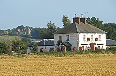
 The Chequers public house The Chequers public house | |
 | |
| OS grid reference | TL034411 |
| Civil parish | |
| Unitary authority | |
| Ceremonial county | |
| Region | |
| Country | England |
| Sovereign state | United Kingdom |
| Post town | BEDFORD |
| Postcode district | MK45 |
| Dialling code | 01234 |
| Police | Bedfordshire |
| Fire | Bedfordshire and Luton |
| Ambulance | East of England |
| UK Parliament | |
| |
How End is a hamlet located in the Central Bedfordshire district of Bedfordshire, England.
The settlement is close to the larger villages of Stewartby and Houghton Conquest. How End forms part of the Houghton Conquest civil parish.
This Bedfordshire location article is a stub. You can help Misplaced Pages by expanding it. |