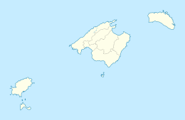
 The island of Tagomago The island of Tagomago | |
 | |
| Geography | |
|---|---|
| Location | Balearic Sea |
| Coordinates | 39°02′00″N 1°39′00″E / 39.03333°N 1.65°E / 39.03333; 1.65 |
| Archipelago | Balearic Archipelago |
| Administration | |
| Autonomous Community | Balearic Islands |
| Province | Ibiza |
| Municipality | Santa Eulària des Riu |
Illa de Tagomago is a private island off the east coast of Ibiza belonging to Spain.
The etymology is likely from tagomago meaning "rock Mago" in reference to Mago Barca, a brother of the Carthaginian general Hannibal. In the Muslim era it was known as Taj Umayu.
It is 1,525 m long and 113 m wide. The island is rocky, with a port and a lighthouse in the extreme southeast. The Tagomago lighthouse was built in 1913 and is a landmark in the shipping routes from Ibiza to Palma de Mallorca and Barcelona. It is 86.3 m above sea level, and its height is 20.4 m.
The island is privately owned by a Spanish family, and has a small tourist facility that politicians and celebrities frequently visit.
Tago Mago, the second studio album by German krautrock band Can, was named after the island.
References
- "TAGOMAGO LIGHTHOUSE". Archived from the original on 3 July 2017. Retrieved 30 July 2014.
- Krukowski, Damon (1998). "Can Interview". Ptolemaic Terrascope.
This Spain location article is a stub. You can help Misplaced Pages by expanding it. |