| Kaliganj কালীগঞ্জ | |
|---|---|
Upazila
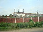
   From top :Mobarakganj Sugar Mills Ltd., Galakata Masjid, Jor Bangla Masjid
 | |
 | |
| Coordinates: 23°24′50″N 89°8′0″E / 23.41389°N 89.13333°E / 23.41389; 89.13333 | |
| Country | |
| Division | Khulna |
| District | Jhenaidah |
| Area | |
| • Total | 310.19 km (119.77 sq mi) |
| Population | |
| • Total | 308,504 |
| • Density | 990/km (2,600/sq mi) |
| Time zone | UTC+6 (BST) |
| Postal code | 7350 |
| Website | kaliganj |
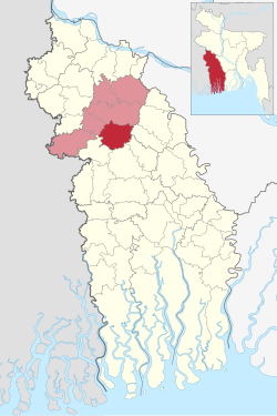
Kaliganj (Bengali: কালীগঞ্জ) is an upazila of Jhenaidah District in the Division of the Khulna, Bangladesh. One of the most important commercial area is Kaliganj under Khulna Division. It crosses between Dhaka Khulna Highway. It has the myth of Gazi Kalu Champabati, The historical mosques of Barobazar, the largest banyan tree in Asia and the flow of Chitra and Begobati. It is bounded by Jhenaidah Sadar on the north, Jessore district on the south, Kotchandpur Upazilla in the west and Magura district in the east.
Geography
Bethuli, Kaliganj is located at 23°24′50″N 89°08′00″E / 23.4139°N 89.1333°E / 23.4139; 89.1333. It has 67,841 households and a total area of 310.19 km. Main rivers are Chittra, Bhairab,Begabati.
Demographics
| Religions in Kaliganj Upazila (2022) | ||||
|---|---|---|---|---|
| Religion | Percent | |||
| Islam | 85.47% | |||
| Hinduism | 14.30% | |||
| Other or not stated | 0.23% | |||
As of the 2011 Census of Bangladesh, Kaliganj upazila had 67,841 households and a population of 282,366. 56,280 (19.93%) were under 10 years of age. Kaliganj had an average literacy rate of 51.97%, compared to the national average of 51.8%, and a sex ratio of 999 females per 1000 males. 45,341 (16.06%) of the population lived in urban areas.
As of the 1991 Bangladesh census, Kaliganj had a population of 219,126. Males constituted 51.76% of the population, and females 48.24%. The population aged 18 or older was 112,587. Kaliganj has an average literacy rate of 29.7% (7+ years), compared to the national average of 32.4%.
Economy


Points of interest
- Naldanga Temple Complex:, in the Kaliganj Upazila, is a temple complex built in 1656 by Maharaj Indranarayan Debroy. There are a total of six temples now. The government restored all of them in 1980s but they were destroyed again during the riot and now most of them are in ruins. Renovations are still going on. The idol of goddess Kali was from Banaras, India.
- The biggest banyan tree in the world is situated at Mollikpur Village under Kaligonj Upazila.
- Baro Bazar: Gazi kalur chompa botir Mazar, Gora Mosjid, Sako bazar mosjid and more than 10 other mosques and more than 5 large dighi (reservoirs) are situated in Baro Bazar of Kaligonj.
- Bulu Deouan er Mazar is another remarkable place in Kaligonj Upazila.
- Kolika Doha is situated in Naldanga, 300 meter distance from Naldanga Temple Complex.
- The Gunjanath temple dates back to the 17th century, also in Kaliganj. It can be reached from Naldanga.
- Alaipur Mosque : A historical mosque has been discovered here in the previous decade.
- Baro bazar fish Market is one of biggest fish market in khulna division
- Sheikh russel mini stadium
- Mobarakganj Sugar Mills Limited
- Mobarakganj railway station
Administration
Kaliganj Upazila is divided into Kaliganj Municipality and 11 union parishads: Bara Bazar, Jamal, Kashtabhanga, Kola, Maliat, Niamatpur, Roygram, Rakhalgachhi, Shimla Rokonpur, Sundarpur Durgapur, and Trilochanpur. The union parishads are subdivided into 188 mauzas and 198 villages.
Kaliganj Municipality is subdivided into 9 wards and 20 mahallas.
Kaliganj Upazila is encompassed by parliamentary constituency Jhenaidah-4.
Member of Parliament :
- Md. Anwarul Azim Anar, MP (5 January 2014 –13 May 2024) in 10th General Election
- Mr. Abdul Mannan, MP (2009–2014) in 9th General Election
- Md.. Shahidul Islam Baltu, MP (1991–1996, February 1996 – June 1996, 1996–2001, 2001–2006) in 5th to 8th General Election
Education
- Government Naldanga Bhushan Pilot Secondary School, Kaliganj was formed in 1882 by Rajadhiraj Pramatha Bhushan Ray Choudhury. It is one of the oldest and notable institutions of Bangladesh.
- G.K United high school.
- Pakh Sharif dakil Madrasa.
- Kastovanga girls high school.
- Gourinathpur govt.primary school.
- Baliadanga M.S Secondary School is one of the oldest high school of Kaliganj.
- Kolabazar Secondary High School,(Kolabazar,Kaliganj)
- Shaheed Noor Ali College
- Sait Baria Haqqul Huda Alim Madrasha
- Mahatab Uddin Degree College, Kaliganj
- Ramnagor College
- Rostom Ali High School, Roghunathpur.
- Solimunnesa Girls' High School, Kaliganj
- Chaprail High School, Kaliganj, Jhenaidah was formed in 1963.
- Mobarakganj Sugar Mills High School, Kaliganj, Jhenaidah
- Hat baro bazar high School,Barobazar
- BAROBAZAR COLLEGE,BAROBAZAR
- Hat Baro Bazar Girls school,Barobazar
- Gazir Hat High School (Gazir Hat, Kaliganj)
- Hasanhati Baro Dhopadi Ebadat Ali High School.
- Hasanhati Govt. Primary School.
- Gopalpur secondary high school,Gopalur
- Panchkahuni secondary High school, kaliganj
- Mongolpaita parkhidha collage, kaliganj
- Bejpara High School, Kaliganj
- Arpara sibnagar model government primary school, kaliganj
- Bhatghara-Doyapur government primary school, Bhatghara-Doyapur, kaliganj
- Naldanga Bushan shishu academy, Kaliganj
- Al-amin precadet school, Kaliganj
- Ashar Alo precadet school, Kaliganj
- Shaheen precadet school, Kaliganj
- Keyabagan hosnin adorsho college, Kaliganj
- Bhatghara high school, bhatghara, Kaliganj
- Shoiaibnagar fazil madrashah, Kaliganj
- Alhaz Amzad Ali Faizur Rahman Mohilla College, Kaliganj
- Kastovanga Government Primary School
Notable people
- Qazi Mu'tasim Billah, Islamic scholar and professor
References
- National Report (PDF). Population and Housing Census 2022. Vol. 1. Dhaka: Bangladesh Bureau of Statistics. November 2023. p. 400. ISBN 978-9844752016.
- "Bangladesh Postal Code". Dhaka: Bangladesh Postal Department under the Department of Posts and Telecommunications of the Ministry of Posts, Telecommunications and Information Technology of the People's Republic of Bangladesh. 21 October 2024.
- Population and Housing Census 2022 - District Report: Jhenaidah (PDF). District Series. Dhaka: Bangladesh Bureau of Statistics. June 2024. ISBN 978-984-475-272-6.
- ^ "Bangladesh Population and Housing Census 2011 Zila Report – Jhenaidah" (PDF). bbs.gov.bd. Bangladesh Bureau of Statistics.
- "Community Tables: Jhenaidah district" (PDF). bbs.gov.bd. Bangladesh Bureau of Statistics. 2011.
- "Population Census Wing, BBS". Archived from the original on 2005-03-27. Retrieved November 10, 2006.
- "MP Anar murder: Another suspect held in India". Dhaka Tribune. 24 May 2024. Retrieved 24 May 2024.
- "Md. Anwarul Azim (Anar), MP of Jhenaidah-4 constituency, inaugurating the shifted Kaliganj". The Daily New Nation. Retrieved 22 December 2018.
| Jhenaidah District | ||
|---|---|---|
| Upazilas/thanas | ||
