| This article uses bare URLs, which are uninformative and vulnerable to link rot. Please consider converting them to full citations to ensure the article remains verifiable and maintains a consistent citation style. Several templates and tools are available to assist in formatting, such as reFill (documentation) and Citation bot (documentation). (September 2022) (Learn how and when to remove this message) |
Place in Kyrenia District, Cyprus
| Karpaseia | |
|---|---|
 | |
| Coordinates: 35°17′52″N 33°04′16″E / 35.29778°N 33.07111°E / 35.29778; 33.07111 | |
| Country (de jure) | |
| • District | Kyrenia District |
| Country (de facto) | |
| • District | Girne District |
| Population | |
| • Total | 89 |
| Time zone | UTC+2 (EET) |
| • Summer (DST) | UTC+3 (EEST) |
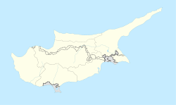
Karpaseia or Karpasha (Greek: Kαρπάσια ; Turkish: Karpaşa) is a village in Cyprus, 2 km south of Myrtou. De facto, it is under the control of Northern Cyprus.
Karpaseia is the smallest village in population amongst the Maronite villages. In 1778, there were 99 inhabitants; in 1973, they numbered 245. Today, only eleven enclaved Maronites remain in Karpaseia, the rest having fled to the south during the 1974 Turkish invasion.
The village church is dedicated to the Holy Cross. Inside the church, there are remnants of wall paintings. The icons date from the 17th century. There are also two ancient wooden crosses of great value: one is Byzantine and dates from the 15th century; the other is rustic Cypriot-Byzantine and dates from the 17th century. The two crosses constitute one of the most important possessions of the Maronite community, which celebrates the protector of the village on 14 September, the day on which St. Helen is said to have found the Holy Cross (14 September 320 A.C.).
References
- In 1983, the Turkish Republic of Northern Cyprus unilaterally declared independence from the Republic of Cyprus. The de facto state is not recognised by any UN state except Turkey.
- "KKTC 2011 Nüfus ve Konut Sayımı" [TRNC 2011 Population and Housing Census] (PDF) (in Turkish). TRNC State Planning Organization. 6 August 2013. Archived from the original (PDF) on 6 November 2013.
- http://www.maronitesofcyprus.com/cgibin/hweb?-A=783&-V=villages
- "KARPASEIA". Internal displacement in Cyprus. PRIO Cyprus Centre. Retrieved 13 November 2014.
- http://www.maronitesofcyprus.com/cgibin/hweb?-A=783&-V=villages
This Cyprus location article is a stub. You can help Misplaced Pages by expanding it. |
