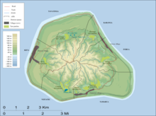
Kei'a (previously Te-apunavai) is one of the six traditional districts of the island of Mangaia, which is part of the Cook Islands archipelago. It is located on the west side of the island, to the south of the District of Tava'enga and west of Veitatei. The district was traditionally divided into 6 tapere:
- Akaoro
- Tapuata
- Tongamarama
- Te-inati
- Rupetau-i-miri
- Rupetau-i-uta
The major habitation is the village of Oneroa, which is home to over half of the island's population. The Auraka cave is also in this district.
References
- ^ Te Rangi Hiroa (1934). Mangaian Society. Honolulu: Bernice P. Bishop Museum. p. 126. Retrieved 9 August 2020 – via NZETC.
- Allen, Bryant (1971). "Wet-Field Taro Terraces on Mangaia, Cook Islands". Journal of the Polynesian Society. 80 (3): 371–378. ISSN 0032-4000. JSTOR 20704790 – via JSTOR.
21°55′S 157°58′W / 21.917°S 157.967°W / -21.917; -157.967
This Cook Islands location article is a stub. You can help Misplaced Pages by expanding it. |