You can help expand this article with text translated from the corresponding article in Polish. (October 2011) Click for important translation instructions.
|
| Kisielina | |
|---|---|
 | |
| Location | |
| Country | Poland |
| Physical characteristics | |
| Source | |
| • location | near Łysa Góra, Lesser Poland Voivodeship |
| Mouth | |
| • location | north of Nowopole, Lesser Poland Voivodeship |
| • coordinates | 50°13′46″N 20°43′35″E / 50.22944°N 20.72639°E / 50.22944; 20.72639 |
| • elevation | 171.1 m (561 ft) |
| Length | 41.37 km (25.71 mi) |
| Basin size | 166.2 km (64.2 sq mi) |
| Basin features | |
| Progression | Vistula→ Baltic Sea |
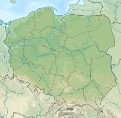
Kisielina is a river in Poland. It flows for 41,37 km (25,7 mi) and feeds off a catchment area of 166,2 km² (64,2 sq mi) before feeding itself into the Vistula, being its right bank tributary.
Kisielina starts on the northern slopes of the Dąbrowa [pl] hill in the vicinity of the village Łysa Góra in the Wiśnicz Foothills [pl]. It is joined by its tributaries: Pokrzywka, Upust (Ulga, right) and Zabawski Ditch (right).
The partial regulation of riverbed from Sufczyn to Biadoliny Szlacheckie took place from 2002 to 2005.
See also
References
- General Geodesic Office of Poland. "Kisielina on the Polish Infrastructure Information map portal". Retrieved 2017-09-05.
- ^ National Water Management Board. "Kisielina on the map portal of the National Water Management Board (search result)". Archived from the original on 2017-09-01. Retrieved 2017-09-05.
{{cite web}}: External link in|author= - General Geodesic Office. "Geographical nomenclature of Poland. Volume 1. Hydronyms. Part 1. Flowing water, springs, waterfalls" (PDF) (in Polish). p. 112. Retrieved 2017-09-05.
| Tributaries of the Vistula River | ||
|---|---|---|
| Forming rivers |
|  |
| Main tributaries of the left bank | ||
| Main tributaries of the right bank |
| |
| Distributary |
| |
This article related to a river in Poland is a stub. You can help Misplaced Pages by expanding it. |