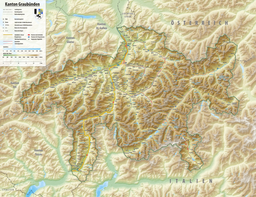
| Lägh da Bitabergh | |
|---|---|
 | |
    | |
| Location | Val Bregaglia, Grisons |
| Coordinates | 46°23′25″N 9°41′09″E / 46.3903°N 9.6858°E / 46.3903; 9.6858 |
| Type | Natural freshwater lake |
| Basin countries | Switzerland |
| Max. length | 125 m (410 ft) |
| Max. width | 85 m (279 ft) |
| Surface elevation | 1,855 m (6,086 ft) |
Lägh da Bitabergh is a lake near Maloja Pass in Val Bregaglia, Grisons, Switzerland.
Access
The lake can be reached on a hiking trail from Maloja in about 40 minutes hiking time. From Lägh da Bitabergh further hiking trails lead to Lägh da Cavloc (45 minutes) or steeply up to Motta Salacina and Pass dal Caval.
References
- ^ Maloja - Lägh da Bitabergh - Lägh da Cavloc on wegwandern.ch (in German)
This article related to a lake in Graubünden is a stub. You can help Misplaced Pages by expanding it. |