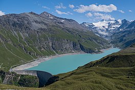
| Lac de Moiry | |
|---|---|
 | |
   | |
 Map of the lake Map of the lake | |
| Location | Grimentz, Valais |
| Coordinates | 46°7′49″N 7°34′14″E / 46.13028°N 7.57056°E / 46.13028; 7.57056 |
| Primary outflows | Gougra |
| Basin countries | Switzerland |
| Surface area | 1.40 km (0.54 sq mi) |
| Max. depth | 120 m (390 ft) |
| Water volume | 78 million cubic metres (63,000 acre⋅ft) |
| Surface elevation | 2,249 m (7,379 ft) |
Lac de Moiry is a reservoir in the municipality of Grimentz, Switzerland.
Geography
The lake has a surface area of 1.40 km² and an elevation of 2,249 m. The maximum depth is 120 m.
The dam is 148 m high and was completed in 1958.
See also
External links
References
- "Swiss Geoportal". geo.admin.ch. Retrieved 2022-12-24.
This article about a Swiss building or structure is a stub. You can help Misplaced Pages by expanding it. |
This article related to a lake in Valais is a stub. You can help Misplaced Pages by expanding it. |