| This article needs additional citations for verification. Please help improve this article by adding citations to reliable sources. Unsourced material may be challenged and removed. Find sources: "Viedma Lake" – news · newspapers · books · scholar · JSTOR (December 2009) (Learn how and when to remove this message) |
| Viedma Lake | |
|---|---|
| Lago Viedma (Spanish) | |
 from space, October 1994 from space, October 1994 | |
   | |
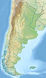
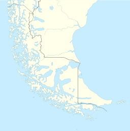
| Location | Lago Argentino Department, Santa Cruz Province (Argentina) |
| Coordinates | 49°35′S 72°30′W / 49.583°S 72.500°W / -49.583; -72.500 |
| Type | periglacial lake |
| Primary inflows | Viedma Glacier |
| Primary outflows | La Leona River |
| Catchment area | 7,342 km (2,835 sq mi) |
| Basin countries | Argentina, Chile |
| Max. length | 80 km (50 mi) |
| Max. width | 15 km (9.3 mi) |
| Surface area | 1,193 km (461 sq mi) |
| Average depth | 100 m (330 ft) |
| Max. depth | ca. 900 m (3,000 ft) |
| Water volume | 119 km (29 cu mi) |
| Shore length | 291 km (181 mi) |
| Surface elevation | 252 m (827 ft) |
| Shore length is not a well-defined measure. | |
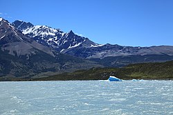
Viedma Lake (Spanish: Lago Viedma, Spanish pronunciation: [laɣo ˈβjeðma]) is a Patagonian lake in the province of Santa Cruz, Argentina, situated near its border with Chile. Measuring approximately 50 miles (80 kilometers) in length, it is a major elongated trough lake formed from melting glacial ice. Viedma Lake is the second largest perennial lake located entirely within Argentina.

The name of the lake comes from the Spanish explorer Antonio de Viedma, who in 1783 reached its shores, being the first European to do so.
The town of El Chaltén and the Andes peaks Cerro Torre and Fitz-Roy lie in the proximity of Lake Viedma.
Lake Viedma is fed primarily by the Viedma Glacier at its western end. The Viedma Glacier measures 3 miles (5 kilometers) wide at its terminus at Lake Viedma. The brown landscape is a result of ice scouring, which left virtually no vegetation on the steep-walled valleys.
Water from lake Viedma flows into Lake Argentino through the La Leona River, and eventually from there into the Atlantic Ocean through the Santa Cruz River.
Although the lake lies in Argentine territory, the western shores of the lake reach the Southern Patagonian Ice Field in an area where the border remains undefined.
See also
References
- Viedma Lake, on lakepedia.com
- Lago Viedma, on uncuyo.edu.ar
- Viedma Lake, on lakepedia.com
- Viedma Lake, on lakepedia.com
- "Principal Lagos de la Republica Argentina", http://www.ign.gob.ar/NuestrasActividades/Geografia/DatosArgentina/Lagos, accessed 20 Jul 2018. Note that this list does not include an area figure for the large but seasonal Mar Chiquita.
This article about a place in Santa Cruz Province, Argentina is a stub. You can help Misplaced Pages by expanding it. |