| Lake Habbaniyah | |
|---|---|
 | |
| Coordinates | 33°17′43″N 43°27′10″E / 33.29528°N 43.45278°E / 33.29528; 43.45278 |
| Primary inflows | Euphrates River |
| Primary outflows | Lake Milh |
| Basin countries | Iraq |
| Surface area | 140 km (54 sq mi) |

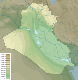
Lake Habbaniyah (Arabic: بحيرة الحبانية Buḥayrat al-Ḥabbāniya) is a lake located halfway between Ramadi and Fallujah near Al-Taqaddum (TQ) Air Base in Al Habbaniyah in Anbar Province, Iraq.
In the late 1930s and 1940s Lake Habbaniyah was used by Imperial Airways as a refueling point and hotel for flying boats flying from the United Kingdom to India. Nearby on the banks of the Euphrates had already been established the Royal Air Force airbase of RAF Dhibban, later renamed RAF Habbaniya.

It was the scene of action during the Rashid Ali rebellion Anglo-Iraqi War when the RAF trainee aircrew and troops stationed there effectively saw off the besieging Iraqi troops and subsequent German aerial attacks.
See also
- 123 Signals Unit RAF
- Al Taqaddum - TQ
- RAF Habbaniya
- Lake Tharthar
- Lake Milh
- Lake Qadisiyah
- Mosul Dam
- List of dams and reservoirs in Iraq
- Wildlife of Iraq
References
- Duraid Adnan and Timothy Williams (23 August 2009). "Dancing by the Waves, Iraqis Forget War for a Day". New York Times. Retrieved 26 December 2015.
- Dudgeon, Mike (2010). "No. 4 SFTS and Raschad Ali's War - Iraq 1941". Journal of the Royal Air Force Historical Society (48). London: Royal Air Force Historical Society: 41. ISSN 1361-4231.
- Fairbairn, Tony (1991). Action stations overseas. Sparkford: P. Stephens. p. 82. ISBN 1-85260-319-4.
- Dudgeon, Mike (2010). "No. 4 SFTS and Raschad Ali's War - Iraq 1941". Journal of the Royal Air Force Historical Society (48). London: Royal Air Force Historical Society: 47. ISSN 1361-4231.
- "Iraq." World Geography: Understanding a Changing World, ABC-CLIO, 2018, worldgeography2.abc-clio.com/Search/Display/1121196. Accessed 10 Apr. 2018.
External links
[REDACTED] Media related to Lake Habbaniyah at Wikimedia Commons
Categories: