| Lake Mogotoyevo | |
|---|---|
| Моготоево озеро / Моҕотой Күөлэ | |
 Sentinel-2 image (2022) Sentinel-2 image (2022) | |
 | |
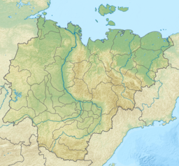
| Location | Sakha Republic, Russia |
| Coordinates | 72°01′24″N 149°08′36″E / 72.02333°N 149.14333°E / 72.02333; 149.14333 |
| Lake type | Coastal lagoon |
| Catchment area | 1,170 km (450 sq mi) |
| Basin countries | Russia |
| Max. length | 34 km (21 mi) |
| Max. width | 15 km (9.3 mi) |
| Surface area | 323 km (125 sq mi) |
| Surface elevation | 1 m (3 ft 3 in) |
| Frozen | late September–June |
Lake Mogotoyevo (Russian: Моготоево озеро; Yakut: Моҕотой Күөлэ, romanized: Moğotoy Küöle) is a coastal lake in Allaikhovsky District, Sakha Republic, Russia.
Geography
With an area of 323 km (125 sq mi), it is the largest coastal lagoon in the Yana-Indigirka Lowland the lake freezes in the second half of September and melts in June. The Bogdashkina river mouth lies to the west of the lake and Gusinaya Bay to the southeast.
Fauna
In the lake, large numbers of omul, Siberian ryapushka and nelma can be found. It is a breeding place for the Siberian crane (Grus leucogeranus).
References
- Sanger, Frederick J.; Hyde, Peter J. (January 1978). Permafrost. National Academy of Sciences. ISBN 9780309027465. Retrieved 31 January 2015.
- nature.ykt - Моготоево
- "S-55_56 Topographic Chart (in Russian)". Retrieved 28 May 2022.
- Google Earth
- "袦芯谐芯褌芯械胁芯". sci-lib.com. Retrieved 31 January 2015.
- "Archived copy" (PDF). Archived from the original (PDF) on 2011-07-22. Retrieved 2011-05-04.
{{cite web}}: CS1 maint: archived copy as title (link)