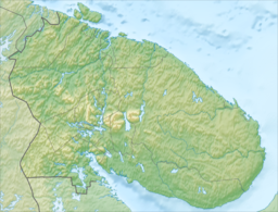
| Umbozero Lake | |
|---|---|
 | |
  | |
| Location | Murmansk Oblast |
| Coordinates | 67°41′45″N 34°22′44″E / 67.69583°N 34.37889°E / 67.69583; 34.37889 |
| Type | Natural lake |
| Primary inflows | Sura River |
| Primary outflows | Umba River |
| Basin countries | Russia |
| Max. length | 44 km (27 mi) |
| Max. width | 10 km (6.2 mi) |
| Surface area | 422 km (163 sq mi) |
| Average depth | 15 m (49 ft) |
| Max. depth | 115 m (377 ft) |
| Surface elevation | 149 m (489 ft) |
Umbozero Lake (Russian: Умбозеро, named after the adherent Umba River) is located in Murmansk Oblast of Russia, between the Khibiny on the west and Lovozero Tundras on the east. Area is 422 km, average depth is 15 m, maximum is 115. The lake freezes from the end of October. Its largest island is Sarvanovsky. Three kinds of fish are found in the lake.
This Murmansk Oblast location article is a stub. You can help Misplaced Pages by expanding it. |