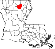
Unincorporated community in Louisiana, United States
| Lakeshore, Louisiana | |
|---|---|
| Unincorporated community | |
  | |
| Coordinates: 32°32′07″N 92°01′46″W / 32.53528°N 92.02944°W / 32.53528; -92.02944 | |
| Country | United States |
| State | Louisiana |
| Parish | Ouachita |
| Area | |
| • Total | 0.94 sq mi (2.43 km) |
| • Land | 0.85 sq mi (2.20 km) |
| • Water | 0.09 sq mi (0.24 km) |
| Elevation | 79 ft (24 m) |
| Population | |
| • Total | 1,988 |
| • Density | 2,341.58/sq mi (904.26/km) |
| Time zone | UTC-6 (Central (CST)) |
| • Summer (DST) | UTC-5 (CDT) |
| ZIP code | 71203 |
| Area code | 318 |
| GNIS feature ID | 548429 |
Lakeshore is an unincorporated community and census-designated place in Ouachita Parish, Louisiana, United States. Its population was 1,930 as of the 2010 census. The community is located on the south bank of Bayou Desiard, east of Monroe.
Geography
According to the U.S. Census Bureau, the community has an area of 0.944 square miles (2.44 km); 0.853 square miles (2.21 km) of its area is land, and 0.091 square miles (0.24 km) is water.
Demographics
| Census | Pop. | Note | %± |
|---|---|---|---|
| 2020 | 1,988 | — | |
| U.S. Decennial Census | |||
2020 census
| Race | Number | Percentage |
|---|---|---|
| White (non-Hispanic) | 987 | 49.65% |
| Black or African American (non-Hispanic) | 843 | 42.4% |
| Native American | 1 | 0.05% |
| Asian | 24 | 1.21% |
| Pacific Islander | 1 | 0.05% |
| Other/Mixed | 75 | 3.77% |
| Hispanic or Latino | 57 | 2.87% |
As of the 2020 United States census, there were 1,988 people, 842 households, and 480 families residing in the CDP.
Education
The school district is Ouachita Parish School District.
It is zoned to Lakeshore Elementary School and East Ouachita Middle School. This area feeds into Ouachita Parish High School.
References
- "2020 U.S. Gazetteer Files". United States Census Bureau. Retrieved March 20, 2022.
- "Lakeshore LA ZIP Code". zipdatamaps.com. 2023. Retrieved June 16, 2023.
- "Lakeshore". Geographic Names Information System. United States Geological Survey, United States Department of the Interior.
- ^ "2010 Census Gazetteer Files - Places: Louisiana". U.S. Census Bureau. Retrieved January 14, 2017.
- "Census of Population and Housing". Census.gov. Retrieved June 4, 2016.
- "Explore Census Data". data.census.gov. Retrieved December 29, 2021.
- "2020 CENSUS - SCHOOL DISTRICT REFERENCE MAP: Ouachita Parish, LA" (PDF). U.S. Census Bureau. p. 14 (PDF p. 15/31). Retrieved January 4, 2025. - Text list
- "Feeder Schools Correlation" (PDF). Ouachita Parish School Board. Retrieved January 4, 2024. - Linked from here. Lakeshore ES boundary map and Ouachita Junior High and East Ouachita Middle School.
| Municipalities and communities of Ouachita Parish, Louisiana, United States | ||
|---|---|---|
| Parish seat: Monroe | ||
| Cities |  | |
| Towns | ||
| CDPs | ||
| Other unincorporated communities | ||
This Louisiana state location article is a stub. You can help Misplaced Pages by expanding it. |