| Legacy Trail | |
|---|---|
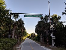
 Legacy Trail near State Road 681 overpass Legacy Trail near State Road 681 overpass | |
| Length | 18.5 miles (29.8 km) |
| Location | Sarasota County, Florida |
| Established | December 21, 2004 |
| Trailheads |
|
| Use | Shared-use for walking and cycling |
| Season | Year round |
| Months | Year round |
| Sights | Payne Park, Oscar Scherer State Park, Venice Train Depot |
| Hazards | Weather, at-grade pedestrian crossing at vehicular thoroughfares |
| Surface | Asphalt |
| Right of way | Seminole Gulf Railway |
| Maintained by | Sarasota County |
| Website | scgov.net/LegacyTrail |
| Trail map | |
| Legacy Trail highlighted in green | |
The Legacy Trail is an 18.5-mile (29.8 km) multi-use recreational rail trail connecting Sarasota and Venice, Florida. It runs along a former portion of the Seminole Gulf Railway corridor (most of which was originally a Seaboard Air Line Railroad corridor). The trail runs from the Historic Venice Train Depot to Fruitville Road in Sarasota. The original segment of the trail from Venice to Palmer Ranch opened in 2008 and it was extended to central Sarasota in 2022.
Route description

The Legacy Trail begins in Venice at the Historic Venice Train Depot. At the depot, which now operates as a bus terminal for Breeze Transit, the trail connects to the Venetian Waterway Park (which runs south along the Intracoastal Waterway to the Gulf of Mexico).
From the Venice Depot, the trail runs north along the former rail corridor, crosses over the U.S. 41 Venice Bypass on an overpass, and enters Nokomis. North of Nokomis, it crosses Dona Bay and passes through Laurel. Another overpass carries the trail over Laurel Road.
North of Laurel, the trail passes underneath State Road 681 and runs through Oscar Scherer State Park, where it connects to the park's trails. It continues north through Osprey and passes Culverhouse Nature Park near Palmer Ranch.
The trail crosses Clark Road just north of Palmer Ranch continues north through Bee Ridge and Sarasota Springs.
The trail crosses Bahia Vista Street and Phillippi Creek before turning west toward downtown Sarasota. At Shade Avenue, A short spur continues west to School Avenue while the main trail turns north and passes Payne Park before terminating at Fruitville Road.
Historic elements

The Legacy Trail references its past as the area's railroad corridor. The trail's milepost numbers (numbered 885–902) correspond to the railroad's original mile numbering. Original trestle bridge crossings remain at South Creek (near Oscar Scherer State Park), Phillippi Creek, and a creek near Beneva Road. Information plaques are placed along the trail detailing the history of the railroad corridor. Roadway crossings on the original segment also include decorative railroad crossing signals with crossbucks reading Sarasota Rail Trail.
North Port Connector
A separate trail connects the Legacy Trail to North Port in southern Sarasota County. The North Port Connector runs for 5.5 miles and begins at Price Boulevard in North Port. It heads north through Deer Prairie Creek Preserve before turning west and paralleling Interstate 75 for over almost four miles. The North Port Connector ends at Forbes Trail and from here, trail users use surface streets and roads (South Moon Drive, Border Road, Edmondson Road, and Florence Street) to access the main Legacy Trail. Florence Street connects to the main Legacy Trail at Nokomis Riverview Park.
History

The railroad line from School Avenue (on the trail's spur) to a point near Beneva Road was initially built in 1903 by Seaboard Air Line Railroad (via their Florida West Shore Railway subsidiary) and was extended south from there to Venice in 1911. Track from Shade Avenue north to Fruitville Road was built in 1927 by the Atlantic Coast Line Railroad (via their Tampa Southern Railroad subsidiary). The Atlantic Coast Line tracks ran directly beside the Seaboard Air Line tracks between Shade Avenue and Beneva Road before the former continued east out of the city. The two parallel railroad lines were consolidated onto the route the trail follows today in 1967 when the Atlantic Coast Line and Seaboard Air Line merged and became the Seaboard Coast Line Railroad (which later became part of CSX Transportation).
In Venice, the railroad line was integral to the city's history and benefited the city's economy. The railroad was used by cadets and faculty of the Kentucky Military Institute for winter classes from 1933 to 1970, transported patients to Fred H. Albee's Florida Medical Center from 1932 to 1942, transported goods and servicemen to Venice Army Air Field during World War II, and used by Ringling Bros. and Barnum & Bailey Circus, which was headquartered in Venice from 1959 to 1992. The circus was the last consistent service the rail line carried.
Owing to decreased demand for service and the heavily deteriorated condition of the tracks and bridges, CSX Transportation and Seminole Gulf Railway, who had been leasing the line from CSX since 1987, came to an agreement with Sarasota County to abandon the railroad line south of Palmer Ranch. In return, Sarasota County, in conjunction with The Trust for Public Land, purchased and acquired the right of way in December 2004 for $11.75 million to use as a public recreational trail. The original 10-mile (16 km) segment of Legacy Trail from Venice to Culverhouse Nature Park near Palmer Ranch opened to the public on March 28, 2008.

In 2011, a pedestrian overpass was built to carry the trail over the U.S. 41 Venice Bypass, a major six-lane highway. The $3.1 million overpass is 18 feet (5.5 m) tall, spans 900 feet (270 m), and was built with federal stimulus funding. Another pedestrian overpass constructed by FDOT over Laurel Road started construction in November 2017 and was completed in late 2018.
In early 2017, Seminole Gulf Railway and CSX announced their intention to abandon an additional 9 miles (14 km) of the remaining southern segment of the railroad up to a point just south of Fruitville Road. In December 2017, Sarasota County, in conjunction with The Trust for Public Land, purchased and acquired 2.7 miles (4.3 km) of the former railroad corridor right of way for $7.9 million, which extended the county's ownership of the corridor up to Ashton Road, approximately one-half mile (0.80 km) north of Clark Road.
In November 2018, Sarasota County voters approved a referendum to acquire and improve 6.3 miles (10.1 km) of the former railroad corridor, extending the trail and constructing the North Port Connector. By early 2020, Seminole Gulf removed tracks and signals from the corridor, and construction for the trail expansion started shortly after.
The first segments of the northern extension, which include the segment from the original trail at Culverhouse Nature Park to Sawyer Loop Road and the segment from Ashton Road to Bahia Vista Street opened on July 8, 2021. The segment from Sawyer Loop Road to Ashton Road opened on October 7, 2021. The final segment from Bahia Vista Street to Fruitville Road opened on March 3, 2022.
The North Port Connector opened on September 9, 2022.
Future
The Florida Department of Transportation is currently building overpasses for the trail at Clark Road and Bee Ridge Road. They are planned be complete in 2025.
The North Port Connector is planned to be extended south from Price Boulevard south to Warm Mineral Springs with completion planned in the 2030s.
The Legacy Trail is planned to be part of the Florida Gulf Coast Trail, a collection of trails connecting Tampa and Naples.
Gallery
-
 Southern terminus near Historic Venice Train Depot
-
Covered benches called "stations" can be found throughout the trail every few miles
-
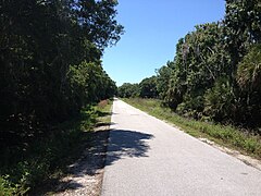
 Legacy Trail near Nokomis
-
 Bridge over Dona Bay
References
- ^ "Historical Overview of The Legacy Trail". Sarasota County Government. March 22, 2018. Archived from the original on April 7, 2018. Retrieved July 31, 2019.
- Brown, Carolyn; Kurant, Lin (August 29, 2017). "Acquisition of Land for The Legacy Trail Extension" (PDF) (Report). Sarasota County Government. General Services. Archived from the original on April 7, 2018. Retrieved September 9, 2021.
- "Sarasota County Trails Plan". Sarasota County Government. Archived from the original on April 5, 2018. Retrieved April 4, 2018.
- ^ "Trailhead Parking and Other Information". Friends of the Legacy Trail. Retrieved May 19, 2021.
- "Legacy Trail Map". Friends of the Legacy Trail. Retrieved May 19, 2021.
- "The Legacy Trail Bicycle Trail in Sarasota from Sarasota to Osprey and Venice, Florida". Archived from the original on December 22, 2017. Retrieved April 7, 2018.
- "Legacy Trail Extension and North Port Connector". Kimley Horn. Retrieved December 28, 2024.
- ^ "Legacy Trail Connector to North Port". Friends of The Legacy Trail. Retrieved December 28, 2024.
- Turner, Gregg M. (December 1, 1999). Railroads of Southwest Florida. Images of America. Arcadia Publishing.
- "The Circus in Venice, Florida". Sarasota Convention & Visitors Bureau. Archived from the original on October 29, 2011. Retrieved November 3, 2018.
- "Sarasota County Legacy Trail Conversion Claims". Maglio Christopher & Toale. Archived from the original on March 27, 2018. Retrieved April 9, 2020.
- "The Legacy Trail Referendum". Sarasota County Government. Archived from the original on April 7, 2018. Retrieved April 6, 2018.
- "Pages - Legacy Trail". Sarasota County Government. Archived from the original on June 20, 2013. Retrieved April 7, 2018.
- Becnel, Thomas (November 4, 2011). "Cyclists cheer Venice's Legacy Trail Overpass". Sarasota Herald Tribune. Archived from the original on September 24, 2015. Retrieved April 7, 2018.
- "Land acquired for Legacy Trail extension". Sarasota County Government. December 20, 2017. Archived from the original on April 5, 2018. Retrieved April 4, 2018.
- "Legacy Trail Update". Sarasota County Government. June 7, 2019. Retrieved June 18, 2019.
- Kimel, Earle (July 8, 2021). "Northern portion of Legacy Trail now open for use, parking limited to neighboring parks". Sarasota Herald Tribune. Retrieved July 16, 2021.
- Kimel, Earle (October 7, 2021). "Legacy Trail now open from Bahia Vista Street to Shamrock Park". Sarasota Herald Tribune. Retrieved October 20, 2021.
- Kimel, Earle (March 3, 2022). "Legacy Trail now extends to Payne Park in Sarasota; trailhead also opens at Webber Street". Sarasota Herald-Tribune. Retrieved March 8, 2022.
- "Construction almost finished on Legacy Trail overpasses". WTSP. December 20, 2024. Retrieved December 28, 2024.
- Kimel, Earle (December 4, 2024). "Legacy Trail connector to Warm Mineral Springs a priority for Sarasota, Manatee region". Sarasota Herald Tribune. Retrieved December 28, 2024.
- "Florida Gulf Coast Trail" (PDF). Trust For Public Land. Retrieved December 27, 2024.
External links
KML file (edit • help) Template:Attached KML/Legacy Trail (Florida)KML is not from Wikidata- Friends of The Legacy Trail, nonprofit organization established in 2006 that supports, promotes, enhances, and protects The Legacy Trail
- TrailLink profile for Legacy Trail
- Legacy Trail at 100 Florida Trails