| Lista | |
|---|---|
| City neighborhood | |
 | |
 | |
| Country | Spain |
| Region | Community of Madrid |
| Municipality | Madrid |
| District | Salamanca |
| Area | |
| • Total | 0.520399 km (0.200927 sq mi) |
| Population | |
| • Total | 21,362 |
| • Density | 41,000/km (110,000/sq mi) |
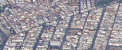
Lista is an administrative neighborhood (barrio) of Madrid belonging to the district of Salamanca. It has an area of 0.520399 km (0.200927 sq mi). As of 1 March 2020, it has a population of 21,362. The Hospital Universitario de la Princesa is located in the neighborhood.
References
- "Callejero vigente. Barrios". Ayuntamiento de Madrid.
- "Población por distrito y barrio". Ayuntamiento de Madrid. Retrieved 20 March 2020.
- "Hospital Universitario de la Princesa". Guía de Arquitectura de Madrid. COAM.
This article about a location in the Community of Madrid, Spain is a stub. You can help Misplaced Pages by expanding it. |
40°25′58″N 3°40′28″W / 40.43278°N 3.67444°W / 40.43278; -3.67444
Categories: