| This article needs additional citations for verification. Please help improve this article by adding citations to reliable sources. Unsourced material may be challenged and removed. Find sources: "Magyarbánhegyes" – news · newspapers · books · scholar · JSTOR (June 2015) (Learn how and when to remove this message) |
| Magyar-bánhegyes | |
|---|---|
| Country | Hungary |
| County | Békés |
| Area | |
| • Total | 36.56 km (14.12 sq mi) |
| Population | |
| • Total | 2,691 |
| • Density | 74/km (190/sq mi) |
| Time zone | UTC+0 (CET) |
| • Summer (DST) | UTC+1 (CEST) |
| Postal code | 5667 |
| Area code | 68 |

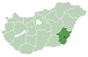
Magyarbánhegyes is a village in Békés County, in the Southern Great Plain region of south-east Hungary.
In the 19th century, a small Jewish community lived in the village, many of whose members were murdered in the Holocaust, also the village also has an old Jewish cemetery,
Geography
It covers an area of 36.56 km² and has a population of 2691 people (2001).
| Békés County | ||
|---|---|---|
| City with county rights |
|   |
| Towns | ||
| Large villages | ||
| Villages |
| |
| Other topics | ||
46°27′N 20°58′E / 46.450°N 20.967°E / 46.450; 20.967
This source shows this place as Magyar-Banhegyes, Austria-Hungary as place of invention pg 798 in 1888
References
- Hungarian Jewish census
- Jews from the village who were murdered in the Holocaust
- The Jewish cemetery in Magyarbánhegyes
- Bibliographic information Official Gazette of the United States Patent Office Title Official Gazette of the United States Patent Office Author United States Patent Office Publisher U.S. Patent Office., 1895 Original from the University of Wisconsin – Madison Digitized Jan 9, 2013
This Békés County location article is a stub. You can help Misplaced Pages by expanding it. |