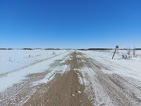
 Provincial Road 255 Provincial Road 255 | ||||
|---|---|---|---|---|
 PR 255 at its western terminus PR 255 at its western terminus | ||||
| Route information | ||||
| Maintained by Manitoba Infrastructure | ||||
| Length | 52.7 km (32.7 mi) | |||
| Existed | 1966–present | |||
| Major junctions | ||||
| West end | Township Road 92, Saskatchewan | |||
| Major intersections | ||||
| East end | ||||
| Location | ||||
| Country | Canada | |||
| Province | Manitoba | |||
| Rural municipalities | Pipestone, Sifton | |||
| Highway system | ||||
| ||||
Provincial Road 255 (PR 255) is a provincial road in the Westman Region of the Canadian province of Manitoba. The road runs from the border with Saskatchewan west to PR 254, north of Oak Lake Beach. Communities along its route include Ebor, Cromer, Woodnorth, and Scarth. It is about 52.7 kilometres (32.7 mi) long.
Major intersections
| Division | Location | km | mi | Destinations | Notes |
|---|---|---|---|---|---|
| Pipestone | | 0.0 | 0.0 | Western terminus; continuation into Saskatchewan | |
| Cromer | 13.1 | 8.1 | Western end of PR 256 concurrency | ||
| 13.2 | 8.2 | Bridge over Pipestone Creek | |||
| 13.4 | 8.3 | Eastern end of PR 256 concurrency | |||
| | 26.5 | 16.5 | Road 159W – Woodnorth | Former PR 252 | |
| Scarth | 34.7 | 21.6 | |||
| 35.6 | 22.1 | Railway Street – Scarth | |||
| Sifton | | 52.7 | 32.7 | Eastern terminus; road continues as Road 49N | |
1.000 mi = 1.609 km; 1.000 km = 0.621 mi
| |||||
References
- "Manitoba Road 255" (Map). Google Maps. Retrieved 19 April 2023.
This Manitoba road, road transport or highway-related article is a stub. You can help Misplaced Pages by expanding it. |