This article has multiple issues. Please help improve it or discuss these issues on the talk page. (Learn how and when to remove these messages)
|
| McPherson Square | |
|---|---|
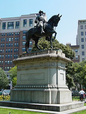
 The Major General James B. McPherson Memorial located in McPherson Square The Major General James B. McPherson Memorial located in McPherson Square | |
| Coordinates | 38°54′7.05″N 77°2′2.85″W / 38.9019583°N 77.0341250°W / 38.9019583; -77.0341250 |
| Public transit access | |


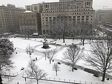
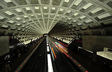
McPherson Square is a public square in downtown Washington, D.C. It is bound by K Street Northwest to the north, Vermont Avenue NW on the East, I Street NW on the south, and 15th Street NW on the West; it is one block northeast of Lafayette Park. It is the sister square of Farragut Square two blocks west. It is served by the McPherson Square station of the Washington Metro.
Statue
The Society of the Army of the Tennessee presented an equestrian statue of McPherson, which was erected at McPherson Square and dedicated on October 18, 1876. The sculpture portrays McPherson surveying a battlefield. It was made by Louis Rebisso out of a captured cannon and rests on a granite pedestal.
History
McPherson Square was part of Pierre L'Enfant's plan of 1791 for the city. The park-like area is named after James B. McPherson, a major general who fought in the Union Army during the American Civil War before he was killed at the Battle of Atlanta.
On October 1, 2011, Occupy D.C. encamped in McPherson Square. On February 4, 2012, United States Park Police officers, citing no-camping statutes, evicted the occupiers.
For many years, McPherson Square endured a substantial homeless camp. In February 2023, the D.C. government and federal government acted to remove all homeless people from the square, despite grassroots opposition. The government argued that the encampments were dangerous, citing an increase in violent incidents, drug use, and criminal activity. Activists countered by arguing that the government was not giving the homeless population a good alternative, and were leaving them with little support while closing down several of their encampments across the city.
Scene
The square is frequented by area workers, street vendors, and restaurant-goers during the day, and homeless people at night. Due to its proximity to the White House, it is the site of political rallies and falls on the path of various protest marches. Adjacent buildings include the U.S. Department of Veterans Affairs, the Lafayette Building housing the Export-Import Bank, the 15th Street financial district, as well as numerous hotels.
References
- "Farragut Square Cultural Landscape". NPS. Retrieved March 28, 2021.
- Austermuhle, Martin (February 5, 2012). "McPherson Square, the Morning After". dcist. Archived from the original on February 2, 2016. Retrieved February 5, 2012.
- Kim, Sarah (February 15, 2023). "'It's Inhumane': McPherson Square Homeless Encampment Cleared, Leaving Some Residents With Nowhere To Go". dcist. Archived from the original on February 16, 2023. Retrieved March 7, 2023.
- DC says two-thirds of homeless from McPherson Square remain on street
External links
- Cartwright, Catherine. "Where in the District: McPherson Square," The Hoya, September 26, 2003.
| Streets and highways of Washington, D.C. | |
|---|---|
| Numbered streets | |
| Lettered streets | |
| State-named roadways | |
| Border avenues and streets |
|
| Other streets | |
| Circles | |
| Squares | |
| Parkways | |
| Expressways | |