| Wigtown | |
|---|---|
| District (1975–1996) Lieutenancy area (1975–) | |
 | |
| History | |
| • Created | 16 May 1975 |
| • Abolished | 31 March 1996 |
| • Succeeded by | Dumfries and Galloway |
| • HQ | Stranraer |
| Contained within | |
| • Region | Dumfries and Galloway |
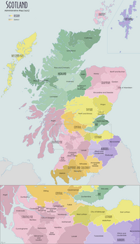
Wigtown is a lieutenancy area in south-west Scotland and a committee area of Dumfries and Galloway Council. From 1975 until 1996 it was also a local government district. It closely resembles the historic county of Wigtownshire, covering the whole area of that county but also including the two parishes of Kirkmabreck and Minnigaff from the historic county of Kirkcudbrightshire.
History
Wigtown District was created on 16 May 1975 under the Local Government (Scotland) Act 1973, which established a two-tier structure of local government across Scotland comprising upper-tier regions and lower-tier districts. Wigtown district was one of four districts created within the region of Dumfries and Galloway. The district covered all of the former administrative county of Wigtownshire plus the parishes of Kirkmabreck and Minnigaff from Kirkcudbrightshire. The 1973 Act named the new district as "Merrick" after the mountain which formed the new district's highest point, but the name was changed to Wigtown prior to the new system coming into force in 1975.
For lieutenancy purposes, the last lord-lieutenant of the county of Wigtownshire was made lord-lieutenant for the new Wigtown district when it came into effect in 1975.
Further local government reform in 1996 under the Local Government etc. (Scotland) Act 1994 saw the four districts of Dumfries and Galloway abolished, with Dumfries and Galloway Council taking over their functions. The council continues to use the former Wigtown district as an area committee, alongside committees for the other three abolished districts of Annandale and Eskdale, Nithsdale, and Stewartry. The area of the former district also continues to be used for lieutenancy purposes as the Wigtown lieutenancy area.
Political control
The first election to the district council was held in 1974, initially operating as a shadow authority alongside the outgoing authorities until it came into its powers on 16 May 1975. Throughout the council's existence a majority of the seats were held by independents:
| Party in control | Years | |
|---|---|---|
| Independent | 1975–1996 | |
Premises
Wigtown District Council was based at Ashwood House on Sun Street in Stranraer, which had been the main offices of the former Wigtownshire County Council prior to 1975. After the council's abolition in 1996 the building became an area office of Dumfries and Galloway Council.
See also
References
- The 1973 Act defined the part of Kirkcudbrightshire to be included in the new district as the Western District except the Anwoth and Girthon electoral division. The Western District had only contained four parishes, being Anwoth, Girthon, Kirkmabreck, and Minnigaff, with the Anwoth and Girthon division corresponding to the combined area of those two parishes.
- "Local Government (Scotland) Act 1973", legislation.gov.uk, The National Archives, 1973 c. 65, retrieved 22 November 2022
- ^ "The Lord-Lieutenants Order 1975", legislation.gov.uk, The National Archives, SI 1975/428, retrieved 27 November 2022
- "Area Committee Community Meetings". Dumfries and Galloway Council. Retrieved 6 September 2013.
- "The Lord-Lieutenants (Scotland) Order 1996", legislation.gov.uk, The National Archives, SI 1996/731, retrieved 25 November 2022
- "Compositions calculator". The Elections Centre. Retrieved 30 November 2022.
- "No. 17824". The Edinburgh Gazette. 24 May 1960. p. 318.
- "No. 19753". The Edinburgh Gazette. 10 October 1975. p. 1318.
- "No. 24539". The Edinburgh Gazette. 22 January 1999. p. 112.
- "Social work offices". Dumfries and Galloway Council. Retrieved 30 November 2022.
| Local government areas of Scotland, in use 1975 to 1996 | ||
|---|---|---|
| Borders |  | |
| Central Region | ||
| Dumfries and Galloway | ||
| Fife | ||
| Grampian | ||
| Highland | ||
| Lothian | ||
| Strathclyde | ||
| Tayside | ||
| Island areas | ||
| The island areas were unitary authorities, combining the powers of a region and a district. | ||
| Council elections in Dumfries and Galloway | |
|---|---|
| Dumfries and Galloway Council | |
| Annandale and Eskdale District Council | |
| Nithsdale District Council | |
| Stewartry District Council | |
| Wigtown District Council | |
54°50′N 4°45′W / 54.833°N 4.750°W / 54.833; -4.750
Categories: