Planning region in Connecticut
| Greater Bridgeport Planning Region | |
|---|---|
| Planning region | |
| Connecticut Metropolitan Council of Governments (MetroCOG) | |
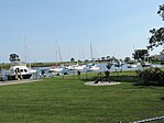
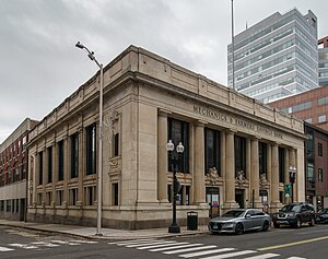
     From top left: Beardsley Zoo, Fairfield County Courthouse in Bridgeport, Stratford Point Light, Southport Harbor, Bridgeport Downtown South Historic District From top left: Beardsley Zoo, Fairfield County Courthouse in Bridgeport, Stratford Point Light, Southport Harbor, Bridgeport Downtown South Historic District | |
| [REDACTED] Logo | |
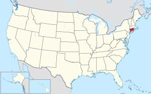
 Location within the U.S. state of Connecticut Location within the U.S. state of Connecticut | |
 Connecticut's location within the U.S. Connecticut's location within the U.S. | |
| Coordinates: 41°11′N 73°11′W / 41.18°N 73.19°W / 41.18; -73.19 | |
| Country | |
| State | |
| Founded | 2013 |
| Largest city | Bridgeport |
| Government | |
| • Executive Director | Matthew Fulda |
| Area | |
| • Total | 140.2 sq mi (363 km) |
| Population | |
| • Total | 325,778 |
| Time zone | UTC−5 (Eastern) |
| • Summer (DST) | UTC−4 (EDT) |
| Congressional districts | 3rd, 4th |
| Website | ctmetro |
The Greater Bridgeport Planning Region is a planning region and county-equivalent in Connecticut. It is served by the coterminous Connecticut Metropolitan Council of Governments (MetroCOG). In 2022, planning regions were approved to replace Connecticut's counties as county-equivalents for statistical purposes, with full implementation occurring by 2024.
MetroCOG policies and activities
MetroCOG is a council of governments and a regional planning organization serving Bridgeport, Fairfield, Easton, Monroe, Stratford, and Trumbull. It regulates economic development, transportation, and environmental quality in the region. MetroCOG also serves as a "host agency" for the Greater Bridgeport and Valley Metropolitan Planning Organization. Mike Tetreau, a Fairfield First Selectman, has served as Executive Director since 2018. The headquarters of MetroCOG is located at 1000 Lafayette Blvd. in Bridgeport.
As of 2018, MetroCOG is looking into initiating a bike-sharing system that would service Bridgeport, Fairfield and Stratford and perhaps Trumbull, Monroe and Easton.
Another priority of the council was to gain a "county government equivalence designation" from the United States Census in order to be able to apply for many federal programs as since 1960, Connecticut has no county governments. This change was made official by the U.S. Census Bureau in 2022.
In 2017 the council worked to secure a $2,050,000 state grant to improve the Pequonnock River trail.
Demographics
| Census | Pop. | Note | %± |
|---|---|---|---|
| 2020 | 325,778 | — | |
| 2022 (est.) | 327,286 | 0.5% | |
| U.S. Decennial Census | |||
As of the 2020 United States census, there were 325,778 people living in the Greater Bridgeport Planning Region.
Municipalities

The following municipalities are members of the Greater Bridgeport Region:
References
- "Governor Lamont Announces U.S. Census Bureau Approves Proposal for Connecticut's Planning Regions To Become County Equivalents". CT.gov. Retrieved March 24, 2023.
- ^ "Change to County-Equivalents in the State of Connecticut". Federal Register. June 6, 2022. Retrieved March 24, 2023.
- http://www.ctmetro.org/ Metropolitan Connecticut website
- https://www.ct.gov/opm/cwp/view.asp?q=383046 Regional Councils of Governments (RCOGs) in Connecticut
- Guinness, Meredith (January 24, 2018). "Fairfield's Tetreau To Lead Regional Metro Council". Bridgeport Daily Voice. Retrieved October 19, 2018.
- Burgeson, John (October 9, 2018). "Area municipalities consider bike-share options". ctpost. Retrieved October 20, 2018.
- Reilly, Genevieve (February 15, 2018). "'County-equivalent' designation could mean more federal money for towns". Fairfield Citizen. Retrieved October 20, 2018.
- Zimmerman, Kevin (February 6, 2017). "Trumbull to receive $2M grant to connect river trail to commercial centers". Westfair Communications. Retrieved October 20, 2018.
- "U.S. Census Bureau QuickFacts: Greater Bridgeport Planning Region, Connecticut; United States". www.census.gov. Retrieved May 13, 2023.
- "About Us". MetroCOG. Retrieved March 24, 2023.
External links
| Municipalities and communities of Greater Bridgeport Planning Region, Connecticut, United States | ||
|---|---|---|
| Cities |  | |
| Towns | ||